
Share this @internewscast.com
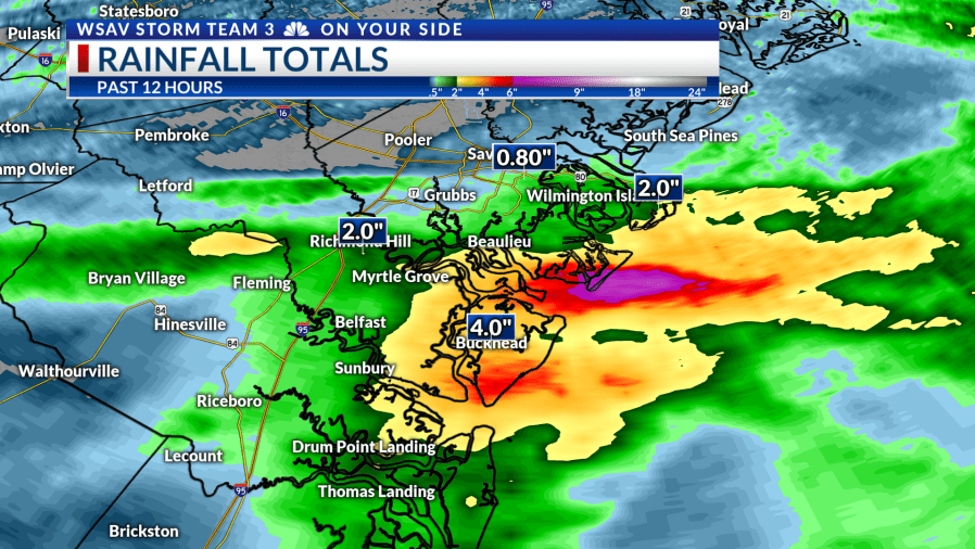
SAVANNAH, Ga. () — Periods of rain showers with very occasional rumbles of thunder brought a gloomy and soggy scene for much of Saturday.
In contrast to the morning’s heavy downpour, the afternoon and early evening saw more manageable rainfall rates, reducing concerns about significant flooding.

Through the night, expect occasional showers with a very slight chance of encountering a thunderstorm or two. Sunday will carry on with mild temperatures and unsettled weather conditions.
Overnight and particularly on Sunday, the risk of localized flooding returns, with our area categorized under a Medium Risk for flash flooding. Stay alert if engaging in outdoor activities and exercise caution when traveling, given the potential for flooded roads.
Few rounds of intense thundershowers are anticipated on Sunday, with some models indicating activity could commence as early as sunrise. Throughout the day, expect intermittent showers following the initial bout of widespread rain and storms.


Monday is predicted to continue similarly, although with more sunshine breaks, leading to slightly warmer temperatures and increased chances for storms.
By mid-week, high pressure will establish itself over the Southeast US, bringing back sunny skies, hot temperatures, and returning rain chances typical of afternoon storms.
The tropics are heating up, as typical for early-to-mid August. There are two tropical waves under investigation by the National Hurricane Center.
Invest 96-L has struggled amidst the dry air and Saharan Dust. Odds of this system developing into a tropical depression or named storm have dipped to 20% over the next 7 days. The system will continue to move northwestward and stay well away from our area.
Invest 97-L is the newest tropical wave to move off of Africa. This disturbance is fairly well-organized for this stage in the game. The NHC is giving the system a 60% chance of developing over the next 7 days. Computer models are very aggressive with this system, likely strengthening it into a formidable tropical storm or hurricane over the Central Atlantic.


What we know about this system is that it will move west-northwestward over the Atlantic Ocean at about 10-15 mph, it has a long road ahead of it due to the dry air over the basin, and it is a week away from even nearing the Caribbean.
The fact that the system does not have a closed center and is not a depression or named storm means we do not know the exact details yet. The next name on the list is “Erin.”
Also, computer models become less clear after about 7-10 days. Essentially, the system’s strength and track coupled with areas of high pressure will help steer the system next week into next weekend.
Some computer models harmlessly turn the system out to sea well east of the United States. Other data suggests the system will travel farther west before making the turn. The range of possibilities remains wide and nothing can be locked in yet.
The bottom line is any idea of the long-term track is not settled yet and you need to check back for updates. This is a good time to evaluate your hurricane plan and check on your kit of supplies.
There are currently no imminent tropical threats for the Coastal Empire & Lowcountry.