
Share this @internewscast.com
A fairly typical hot, humid, unsettled pattern will be in place for the Coastal Empire and Lowcountry.
Summer Pattern Has Arrived
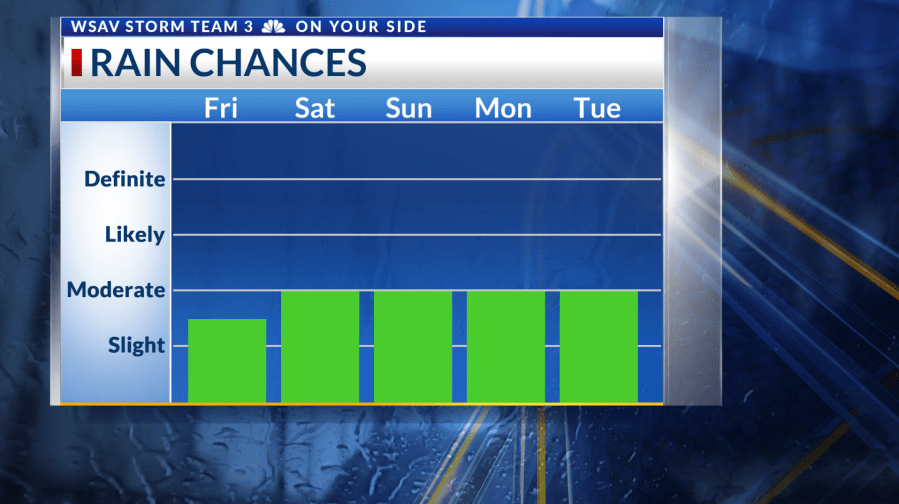
Friday begins with temperatures ranging from the upper 60s to lower 70s, with partly cloudy skies overhead. During the afternoon, isolated showers and thunderstorms are expected to develop.
Coverage will amount to about 30-40% with the low-end possibility of a strong storm or two.

Weather Aware Saturday
This weekend, there is an increased likelihood of rain and a potential for severe weather with any storms that occur. However, typical of this time of year, neither Saturday nor Sunday is expected to experience continuous rainfall.
Stronger to severe storms may produce damaging straight-line wind gusts. A Weather Aware Day has been set for Saturday due to the risk of severe weather.

Heavy rainfall may bring localized flooding, especially for areas that drain poorly. Rain chances will be maximized with both peak daytime heating and storm complexes moving in from the west.
Heat
Outside of rain chances, heat and humidity will bring an unpleasant feel if you have outdoor plans. Temperatures will be in the lower to middle 90s with a heat index in the lower 100s.