Share this @internewscast.com
Thursday afternoon in Savannah, Ga. brought hot and stormy weather, with some areas experiencing heavy rain, while others stayed dry.
There are some changes though as we head into the Independence Day weekend.
A LOOK AHEAD
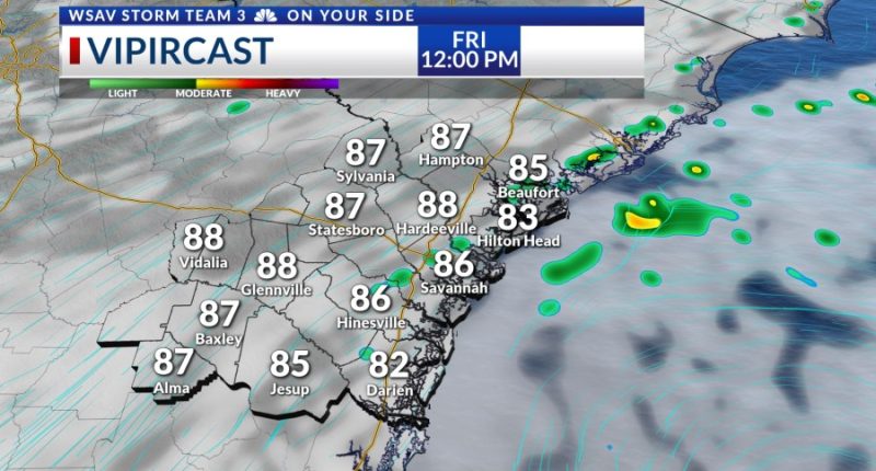
The long holiday weekend will start out mainly hot and dry on Friday. Highs will top out in the lower 90s with heat index values in the upper 90s.
While Independence Day itself will be drier than earlier in the week, rain chances are not going away all together.
If you’re planning to be outside or watch any fireworks displays, remember to stay alert. Remember, if you hear thunder, head indoors.
The weekend weather forecast may be influenced by potential tropical activity near our coast. However, we do not anticipate any significant changes to our local weather, even if development occurs.
Saturday and Sunday will not be a washout, but we will have a few scattered showers and storms. Afternoon highs will be in the upper 80s to lower 90s. Conditions near the coast may be breezy at times.

A drier and hotter pattern is expected to set up as the potential tropical low moves north or northeast of or region by Monday. Afternoon highs by mid-week will be topping out in the mid to upper 90s for most locations.
There is an off chance that we will see a few isolated afternoon showers or storms each day. However, the heat will be the main weather story next week.
TRACKING THE TROPICS
Some slow tropical development may happen just off of our coast over the weekend. A disorganized area of cloudiness is moving off of the east coast of Florida Thursday evening.
It will be moving into an area that is marginally conducive for tropical development over the next several days as it drifts north or northeast along the coast.
The overall development risk is medium at 40% over the next two days. Then the risk increases over the next 5-7 days to 60%.
It will be over the very warm waters of the Gulf Stream which would help fuel further storm development and organization.
Any local impacts will be minimal and concentrated to the coast. This system would likely become better organized as it is already drifting north or northeast of our area over the weekend and into next week.
Local impacts would be breezy wind, high surf, and possibly a rip current risk. Again, local impacts look to be minimal at this time.


