
Share this @internewscast.com
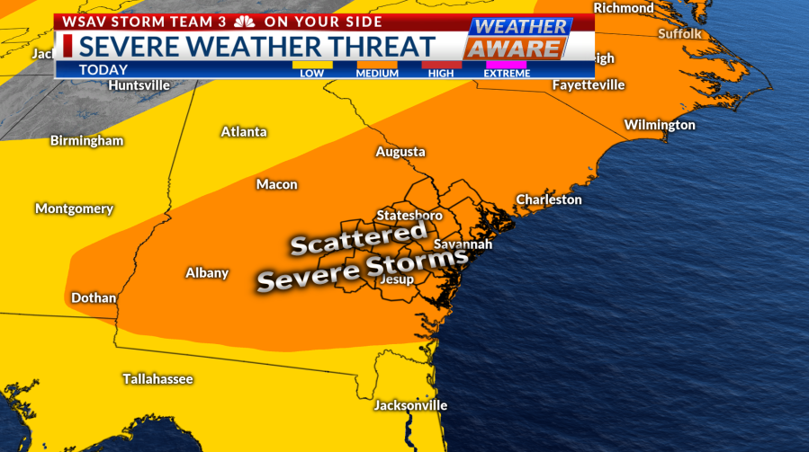
Today is another Weather Aware Day due to the potential for strong to severe storms in the afternoon and evening. The weather remains hot and humid with temperatures reaching the low 90s, and the heat index in the triple digits adds more energy to fuel today’s storms. The storms are expected to approach from the west around lunchtime and continue through the evening. The primary threats include damaging and gusty winds, heavy rain, and possibly isolated hail, while the tornado risk still exists to some extent.


Monday will also be a Weather Aware Day because of strong to severe storm possibilities. Similar to today, the storms tomorrow are expected from lunchtime through the evening, although the threats will vary slightly. There is an increased risk of brief tornadoes with strong storms, in addition to gusty and damaging winds and heavy rain.

The severe storm risk may persist throughout the work week as temperatures remain in the 90s and heat index values hover around the triple digits, providing extra energy for storms. As we monitor the stationary front to our north and west this week, there is a chance of scattered storms each day.
Make sure to have multiple ways to receive alerts. Our Weather Now app is a great tool.