Share this @internewscast.com
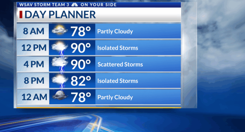
SAVANNAH, Ga. () — A steamy morning will give way to a hot and humid one by this afternoon as temperatures in the low to mid 90s will feel like 105°.
A stalled frontal boundary will help the warm, humid, and unstable atmosphere bring an unsettled one across the area.
By the afternoon, scattered showers and thunderstorms will emerge, leading to heavy rainfall in most regions. There’s also a possibility of encountering gusty straight-line winds in some areas.
Use caution with any driving this afternoon and evening as flooding will become an issue in areas that receive heavy rain. Turn around, don’t drown!
Sunday brings isolated storms and another hot, humid day. However, there will be less atmospheric instability and lift, which means the storms will be more sporadic, unlike the persistent activity we observed on Saturday.
Thanks to northeast winds generated by the distant Hurricane Erin, our area should experience mostly dry conditions throughout the workweek. Nevertheless, expect hot and humid weather with the possibility of isolated showers and storms from Monday to Wednesday.
As of the 5 AM advisory by the National Hurricane Center, Hurricane Erin has escalated to a major hurricane. The storm began to intensify quickly late last night and is anticipated to continue doing so throughout Saturday.
Additional data from NOAA and Air Force Reserve Hurricane Hunters found the system having 145 mph winds at 8 AM.
Future forecasts and computer model trajectories from the National Hurricane Center indicate that the system is likely to shift northward, remaining safely east of The Bahamas and Florida, thus staying well to the east of the US East Coast.
This powerful hurricane’s extensive reach could result in dangerously high surf and a significant risk of rip currents affecting the shores of the Coastal Empire and Lowcountry.
No direct impacts are expected to the area but be safe if you have any beach plans due to the dangerous surf conditions.
An area of low pressure off the North Carolina coast has a 10% chance of developing. This will not pose any threat to the US.


