
SAVANNAH, Ga. () — Wednesday afternoon was mainly dry.
Nevertheless, showers and thunderstorms became more widespread during the early evening hours. Today, most areas experienced high temperatures in the upper 80s to lower 90s, with the heat index hitting 100°F in some spots.
A LOOK AHEAD
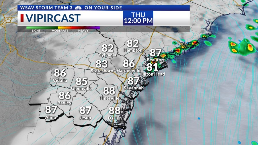
On Thursday, expect more scattered showers and thunderstorms. The likelihood of storms will increase after midday and extend into the early evening. Thursday’s afternoon high temperatures will range from the upper 80s to lower 90s.


For Independence Day on Friday and moving into Saturday, rain and storm chances will decrease slightly. Friday will see hotter afternoon highs, reaching from the low to mid 90s, with the heat index making it feel like the upper 90s to around 100°F.

Temperatures Saturday will be back into the lower 90s for most locations with a few passing showers or storms in the afternoon. Similar conditions are expected for Sunday afternoon.
The new workweek will start off with a few showers and storms on Monday.
A drier pattern is expected to set up for the middle part of the week and that will help temperatures to warm into the mid to upper 90s for most locations. Heat index values will be in the upper 90s and into the triple digits.

TRACKING THE TROPICS
The NHC continues to monitor an area of cloudiness in the northern Gulf and over Florida for the potential for tropical development over the next five to seven days.
Right now, there is a medium risk (40%) for either a tropical depression or tropical storm developing off of the southeast U.S. coast.
A slow-moving cold front may help a more defined low form by the weekend. Any development would be slow to happen.
Regardless of development, the main concern will be heavy rain over Florida over the next few days.
There is no significant threat to the Coastal Empire and Lowcountry at this time as most of the moisture will stay well off of the coast with drier air over land.