
Share this @internewscast.com
SAVANNAH, Ga () — Tuesday afternoon was a continuation of the nice weather pattern from Labor Day.
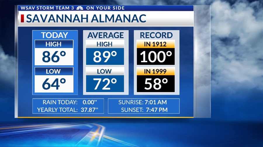
Afternoon highs were in just the low to mid 80s thanks to a mainly sunny sky.
The wind gusts were occasionally strong, enhancing the feeling of comfort. However, in the coming days, expect a shift towards a warmer and more humid climate.

A LOOK AHEAD
On Wednesday, morning temperatures are anticipated to fall in the low to mid-60s. A mixture of partly to mostly sunny conditions will elevate afternoon temperatures to the mid to upper 80s.


By the end of the week, temperatures will rise further, with afternoon highs reaching the low 90s by Friday. Typically, early September sees highs in the upper 80s.
Humidity levels will be increasing, especially for late week. Heat index values in the upper 90s at times on Friday and into the weekend.
Despite more humid conditions setting up Friday through Sunday, rain and storm chances really will not return to the forecast until next week.
Just a few passing showers are expected later this week and over the weekend.
Next week is looking to stay somewhat unsettled with scattered showers and storms setting up along with temperatures cooling back into the 80s.


TRACKING THE TROPICS
The National Hurricane Center is closely observing a tropical wave that has recently left the west coast of Africa and is currently positioned southwest of the Cape Verde Islands.
This broad low-pressure zone is experiencing the development of convective thunderstorms. As it progresses westward, gradual and slow development is likely in a conducive environment.

As of Tuesday evening, there is a high 70% probability of it developing into a tropical depression or tropical storm within the next 5-7 days. Forecasts suggest this system will remain far off the eastern U.S. coast late next week.
This would be a similar path to Hurricane Erin which stayed a few hundred miles to the east and the primary concern was high surf and rip currents.
There is no threat to the United States right now from this system.