
Share this @internewscast.com
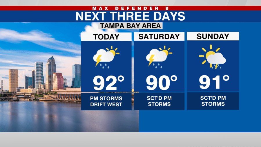
In Tampa, Florida this morning, you’ll notice a few clouds. We can expect partly sunny skies today, with temperatures rising to the low 90s by the afternoon, and it will feel slightly more humid.

Today’s rain chances have increased to 50%. Showers and storms are likely to form on the east coast and move toward the west coast during the evening.
This weekend, the likelihood of rain remains high, with storms developing early in the afternoon and lingering throughout the day. Temperatures will continue to be in the low 90s, and certain areas may experience muggy conditions.

Rain chances will increase even more next week as another front drops in from the north and stalls out over the area.
There is a tropical wave, identified as Invest 91L, which is currently progressing westward through the central Atlantic. It is starting to show signs of organization and may turn into a tropical depression by the weekend. Forecast models are uncertain about its path, alternating between east and west.

Though this tropical wave needs monitoring, it is still over 3,000 miles away from the Tampa Bay area and is more than 10 days from potentially impacting the outer Caribbean Islands, possibly near the end of next week.