
Share this @internewscast.com

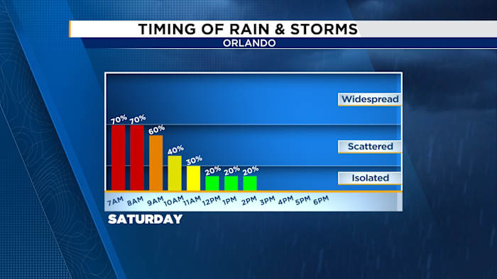
ORLANDO, FL – This Saturday, a cold front will move into Central Florida, introducing scattered showers and thunderstorms throughout the morning. Some of these storms may intensify, producing heavy rainfall, strong winds reaching 40–60 mph, and possibly small hail.
Osceola, Brevard, and Polk counties have been issued a marginal risk, but strong storms can develop anywhere in the region, particularly in the early hours of the day.
The stormy conditions will not dominate the entire day. By late morning, the weather is expected to improve as drier air arrives, which will gradually decrease humidity levels and clear the skies.
The afternoon will be a nice break from the intense heat, with highs in the mid to upper 80s—a noticeable cooldown from the sweltering 90s we’ve seen lately.
A few isolated showers could still develop in the afternoon, but most areas should stay dry. Sunday looks even better, with low rain chances and highs climbing back into the upper 80s to low 90s under mostly sunny skies.
Copyright 2025 by WKMG ClickOrlando – All rights reserved.