Share this @internewscast.com

ORLANDO, Fla. – The peak of hurricane season is drawing near, as evidenced by the Atlantic’s attempts to create tropical systems even under “hostile” or “quite unfavorable” conditions.
There comes a point where background conditions can only do so much given the time of year.
While a sudden surge in tropical activity isn’t expected immediately, there is a growing indication that activity will ramp up significantly after September 11.
The possibility remains for the season to bring another named storm or two before ideal conditions emerge, although any system that attempts to form will face challenges. Let’s examine the details.
What’s so ‘hostile’ about the Atlantic?
Recently, a notable pulse of the Madden Julian Oscillation passed through the tropics, contributing to the development and potential rapid strengthening of Erin when it was north of the Greater Antilles. This phase has now moved on, currently focusing its influence over Thailand, Indonesia, Australia, and the eastern Indian Ocean stretching to the Western Pacific.
In the atmosphere, upward movement inevitably leads to downward motion elsewhere. As the Pacific experiences enhanced rising activity, the Atlantic faces a suppression, resulting in a downward motion from top to bottom in the atmosphere.
That’s when you start to see an increase in low and mid level wind shear, as well as more dry air building in.
It might be surprising, but alongside these incidental factors we discuss during hurricane season, Earth’s tilt and journey around the sun also play a role in the formation of the storms we monitor as they travel from east to west.
We’re for sure into peak summer and coming out of it at that. This means we’re receiving the bulk of the sun during the daylight hours. Because of Earth’s tilt, we see less of it during our winter months and the same goes for the tropics. Right now, they’re directly beneath all that incoming sunlight and heat, which is why we get the shift in where our tropical waves move about.
That’s why, regardless of how “bad” the state of the atmosphere and water temperatures may be in the Atlantic where it matters most for development, you’ll still see waves attempt to grow a little.
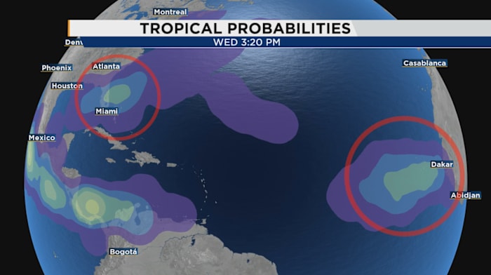
The National Hurricane Center shows us that, after highlighting an area for a 20% chance of formation through next week as one of these tropical waves comes off Africa.
So wait – what’s the second spot we’re watching?
Despite the wave being our only identified feature through the tropics right now, I’m also closely watching what occurs off both of Central Florida’s coastlines. We’ve had some pretty powerful cold fronts coming down, unseasonably strong.
As a result, our computer models tend to struggle some when things go into unusual territory. There’s a very low potential we see another rogue spin-up along a leftover front either to our west in the Gulf or toward our east over the Gulf stream current of warmer water.
This wouldn’t be out of the ordinary and actually par the course since we’ve had Chantal and Dexter already come together thanks to the same type of set up. Computer models show broad rotation near the Florida peninsula, and nevertheless we’ll still see a huge hike upward in our rain chances Labor Day weekend and into next week.
The question from there is how far south the front comes down, and does it get the chance to percolate over the water?
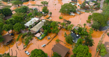
That same front, even if it no piece of it tries to develop, will dump some hefty rain totals on us through the upcoming holiday weekend and into the first couple days of next week.
This is all thanks to the set up left behind and more or less provoked by Hurricane Erin several days earlier.
Then from there, we may see one more attempt or two in the greater tropical Atlantic before the peak of the season really tries to stretch its legs. I am fairly confident after Sept. 10 and especially Sept. 15 that conditions over the Atlantic will start to reverse and we’ll see what this hurricane season truly has in store for us.
Copyright 2025 by WKMG ClickOrlando – All rights reserved.


