
Share this @internewscast.com

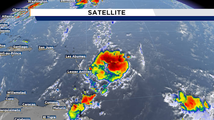
ORLANDO, Fla. – In the 8 a.m. update from the National Hurricane Center, Invest 99L is showing improved organization, characterized by developing showers and thunderstorms.
Though it lacks a closed surface circulation at this moment, it might evolve into a tropical depression within a day or two as it progresses west toward the Leeward Islands.
This system is projected to enter the central Caribbean by Tuesday. Initial forecasts are in good agreement on this path early in the week, but as the days progress, uncertainty increases regarding its precise center location.
If it strengthens into a named storm, the next name on the list is Gabrielle.
In the meantime, Tropical Storm Fernand formed yesterday afternoon over the open Atlantic. Current projections maintain it as a weaker system over water, with no anticipated impacts on land.
For now, there are no tropical concerns for Central Florida.
[LATEST FORECAST: Scattered heavy rain possible across Central Florida]
Copyright 2025 by WKMG ClickOrlando – All rights reserved.