
Share this @internewscast.com

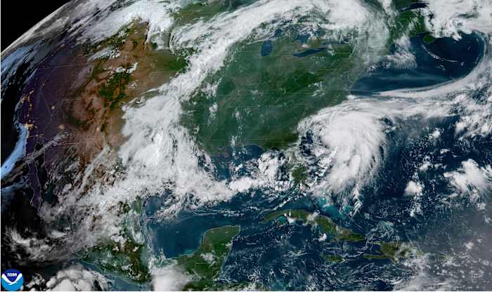
MIAMI – Tropical Storm Chantal intensified as it neared the southeastern coast of the U.S., with predictions of heavy rainfall for portions of the Carolinas on Sunday.
Tropical storm warnings were issued for portions of the two states, the National Hurricane Center in Miami said.
The storm was located approximately 75 miles (120 kilometers) east of Charleston, South Carolina, and 85 miles (136 kilometers) southwest of Wilmington, North Carolina, early on Sunday. It had maximum sustained winds of 60 mph (96 kph) and was heading north at 8 mph (13 kph).
Rain bands from Chantal were moving onshore, the hurricane center said, with flash floods an increasing concern.
The storm was expected to make landfall in South Carolina in the next few hours and weaken rapidly as it continues over land.
Forecasts indicated heavy rainfall for parts of North Carolina extending into Monday, expecting total precipitation of 2 to 4 inches (5 to 10 centimeters) with localized amounts reaching up to 6 inches (15 centimeters), potentially causing flash flooding.
South Carolina’s Emergency Management division had warned residents earlier of the possibility of isolated tornadoes along the coast and of minor coastal flooding.
It also warned drivers not to venture on water-covered roads or around road-closure signs where flooding occurred.
Copyright 2025 The Associated Press. All rights reserved. This material may not be published, broadcast, rewritten or redistributed without permission.