
Share this @internewscast.com

BREVARD COUNTY, Fla. – On Wednesday afternoon, two construction workers tragically lost their lives amid severe weather conditions in Brevard County. Strong winds from thunderstorms to the south might have contributed to the crane toppling over.
The highest recorded wind speed at the incident’s time was 58 mph, meeting the National Weather Service’s severe thunderstorm criteria.
The warning was not issued, and perhaps this is a repercussion of the recent and hefty cuts they’ve experienced throughout the agency as a whole.
Currently, there is no clear information on whether an investigation is underway to determine the cause of the collapse. However, it’s clear that being outside during severe weather significantly increases the risk of accidents.
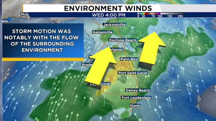
Yesterday, Central Florida was forecast to see a lot of heavy rain, with limited significant thunderstorm activity because of the type of conditions in play. Usually, we need lots of heat, a trigger, and energy in the low to mid levels of our environment to spark strong if not severe storms.
We’ve experienced this many times, and we’re no stranger to the afternoon sea breeze producing lots of lightning, hail stones, and the synonymous winds that can produce damage similar to that of a hurricane or tornado.
In fact, straight-line winds are often confused with that of a tornado because of the intensity and destruction they bring to the table. I personally have experienced instances of straight-line winds here in Central Florida, in desert environments out west, and overseas in the Middle East. They come in different styles and it all boils down to the local area itself.
That’s exactly what I want to break down with you all today in this article.
So, what are straight-line winds?
Right away, every single thunderstorm you observe as you go about your business throughout the day carries with it a lot of wind and a LOT of MASS. Yes, when I say mass, I truly mean exactly as you’d hear in your classic physics class.
A thunderstorm — albeit we imagine clouds as weightless, wispy pillows in the sky — is HEAVY. Channel your inner Marty McFly with me, “This is heavy, Doc.”
What occurs inside a thunderstorm are two distinct mechanisms that drive the winds inside a storm structure. You have your updraft on one side and the downdraft on another. The downdraft is typically where you find your rainfall. As the name implies, that’s why it’s falling, the downward movement of winds and precipitation in the individual storm.
Some of the different ingredients we mention here in the digital realm and on air go into forecasting if a storm is capable of creating winds strong enough to cause destruction or even injury.
Things like storm energy, dry air, warm and cooler air all play a role in how much of a punch these currents of winds can carry.
One factor that could have influenced the intensity of the thunderstorms we saw earlier on in the day yesterday is the Saharan dust. Stick with me here. Usually we hear how the dust tends to cap off any bad weather and how it is especially suppressive with anything tropical in the Atlantic, but research has shown the dust itself can sometimes behave like the dry line phenomena more commonly seen in eastern New Mexico and west Texas.
By that I mean in certain instances, it can help versus hurt storm growth whether it be local weather or your spins in the tropics. It’s all a matter of whether the area can win the meteorological “lottery,” as I like to call it.
So there could be a case where despite having no severe risk highlighted for Central Florida, as the first bits of the dust plume rolled in, it helped act as a bit of a trigger for further thunderstorm growth before really capping us off like we see in our skies today.
Dusty air is warm but it is dense. Density plays a huge role in thunderstorms, especially when talking about a storm’s updraft and downdraft strength. If we introduce a bit of drier air into the mid to upper portions of your thunderstorm, it actually HELPS encourage the storm to strengthen. Kind of reminds you of the phrase, ‘Too much of a good thing is a bad thing.’
We see straight-line winds when an updraft carries so much weight at once, it suddenly collapses. Your updraft loses the upward motion that helps bring the thunderstorm to life. I’ll hit you with another phrase, “What goes up must come down” — all that wind, rain, and energy then comes down right on top of you.
Oftentimes you can see this on a radar when your favorite meteorologist is on television breaking down the local threats in your neighborhood. This is almost always the case when we see our afternoon sea breeze begin. The sea breeze in itself has a lot to do with heat and density, but we can save that for a future discussion together.
Yesterday the environment was primed to produce some quality downrush winds as they’re coined. As the name suggests, you have mass in the form of winds moving downward toward us at the ground. When these winds meet the ground, they can’t go through it, so they aggressively fan out in all directions producing the straight-line wind event.
Given the size and vertical extent of a crane, reaching sometimes several hundred feet into the air, these winds and the natural density said winds carry can topple huge structures. This is precisely why NWS provides us with warnings for severe winds. It is also why it distinctly uses the words “damaging winds” in its warning narratives to alert us of what’s occurring.
Unfortunately, the forecast seemed to bust yesterday. A special weather statement was issued for winds in excess of 40-50 mph. These are considered sub-severe criteria. But there’s a reason we have levels to the info we put out and why the severe thunderstorm WARNING was warranted given what was happening in real time.
Why Watches, Warnings and Advisories matter TO YOU
There are three distinct categories of alerts we utilize in meteorology: Watches, Warnings, and Advisories. We used to characterize them as “WWAs” in Air Force Weather during my time as a USAF forecaster.
They are indeed designed to act as levels for bringing situational awareness to a bad weather scenario.
A WATCH simply means we have what we need to create potentially destructive weather. An ADVISORY is a general “heads up,” we’ve got some inclement weather headed your way that may cause problems if you’re outside, on the road, working outdoors, and so on.
A WARNING, like one you’d receive from a partner, a friend, a coworker, a boss, means, “Look, something big is going down and I’m warning you to take heed.”
In a separate article or discussion coming soon, I want to break down a bit of the “lead time” behind these individual categories. Lead time is very important to you all and plays a vital role in keeping you safe when something weather-related strikes your area.
Copyright 2025 by WKMG ClickOrlando – All rights reserved.