
Share this @internewscast.com

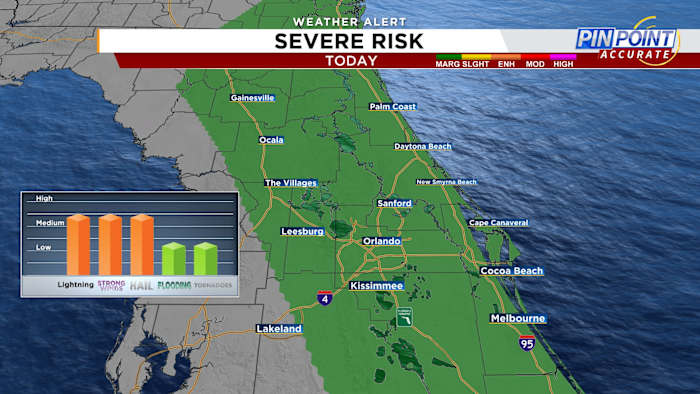
ORLANDO, FL – Central Florida is set to experience a damp day, with scattered rain and storms appearing throughout the morning, continuing into the afternoon. The most intense storms could arise east of I-4 later in the day. There’s a Marginal Risk for severe weather, so be prepared for periods of heavy rain, wind gusts up to 60 mph, and potentially hail up to an inch in diameter. An isolated tornado cannot be completely ruled out.
Expect highs to climb into the mid to upper 80s and it’s not going to rain non-stop—there will be some dry spells between the rain.
TIMING:
Northern counties are expected to encounter rain and storms this morning, which will persist until late morning. In the western counties and the metro area, rainfall is anticipated through the morning extending into the afternoon. Later in the day and into the night, scattered rain and storms will persist closer to the coast, with the strongest ones probably developing from the afternoon into the evening.
Looking ahead to Monday, we’ll get another round of scattered showers and storms, strongest storms are possible along the coast.
Temperatures are going to rise, reaching the low 90s by midweek, although chances of rain will be lower. However, by the end of the week, rain probability will increase again.
Copyright 2025 by WKMG ClickOrlando – All rights reserved.