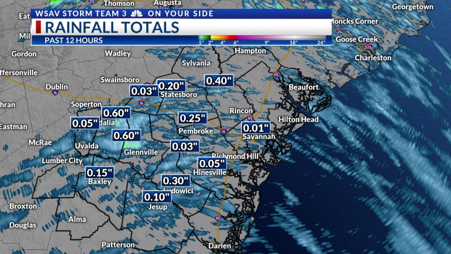

SAVANNAH, Ga. () — Tuesday afternoon was hot and humid with a few passing showers and storms.
Most of the area missed out on significant rainfall. Though the rain was heavy where it did fall.
Most of the showers were fast moving due to a strong onshore breeze due to the circulation of a system to our south that may become tropical.


The system located to our south won’t have direct effects on our region. Nonetheless, it will contribute to reducing rain chances in the coming days.
A LOOK AHEAD
Wednesday through Saturday will be hot and humid with a few passing showers or storms. Rain chances each day are at 30%.
Showers or storms that may form, particularly on Wednesday and Thursday, will move quickly owing to a strong breeze caused by the area of low pressure currently being monitored over northern Florida.


Afternoon temperatures will slowly rise, reaching the mid to upper 90s on Friday and Saturday. At times, the heat index could exceed 105°F.
As hot as our high temperatures will become, we will not be talking about record breaking highs in our local forecast.
Records this week in July range from 101°F to 105°. The all-time record high of 105°F for Savannah was set back in 1879 and in 1986.
A more unsettled pattern will set up again on Sunday and into early next week. Scattered showers and storms are expected each day. Temperatures will remain above average in the low to mid 90s.


TRACKING THE TROPICS
We continue to track a broad area of low pressure that is now located over northeast Florida for potential tropical development. It has been causing heavy rain and breezy conditions.
Conditions have been breezy even in the Coastal Empire and Lowcountry because of this system.


The National Hurricane Center gives this system a medium (40%) chance of developing into a tropical depression or tropical storm over the next 5 days.
Much of the model guidance keeps this low over land or very close to the northern Gulf coast. This would mean a fairly weak system that will move toward Louisiana. Heavy rain and breezy conditions are expected along the Gulf coast through the week.
Some of the moisture may make its way back toward the southeast Atlantic coast over the weekend or early next week and enhance our rain chances.
No direct tropical impacts are expected in Georgia or South Carolina at this time.