
Share this @internewscast.com
SAVANNAH, Ga. () — Thursday afternoon was another very hot and humid day with highs in the mid to upper 90s.
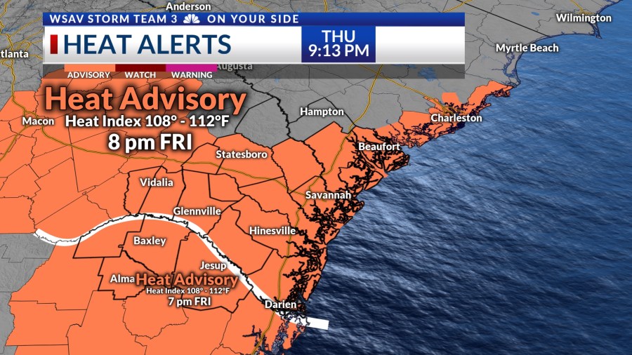
Afternoon heat indices soared past 105°-110°F for much of the day, with similar conditions expected on Friday. A shift towards cooler and wetter weather is anticipated for the weekend.
A LOOK AHEAD
Friday morning will begin mostly sunny and quite warm. Plenty of sunshine will allow temperatures to rise into the upper 80s to lower 90s by midday.
Afternoon highs will top out in the mid to upper 90s with hotter heat index values.
Heat advisories have been issued for most of the Coastal Empire and Lowcountry for Friday due to heat index values possibly over 108°F.

A few strong or severe showers or storms are possible Friday afternoon and into the evening hours. Gusty wind will be the main concern.
A cold front will slowly move into the southeast late in the day and that will help rain and storm chances to increase.

Scattered rain and storms are expected to start Friday night, continuing intermittently through the weekend. Both Saturday and Sunday will see scattered rain and storms, occasionally bringing heavy rain. Expected rainfall totals range from 2-4″, with some areas possibly receiving more.
Localized flooding is possible in areas with poor drainage. Be careful on the roadways as conditions may be treacherous at times.


Due to the high likelihood of rain and increased cloudiness, temperatures will stay below normal. Highs for Saturday and Sunday are forecast to be in the mid 80s.
Next week will get gradually warmer as rain chances begin to backoff. However, afternoon highs will remain below normal.
TRACKING THE TROPICS
The National Hurricane Center isn’t currently tracking any tropical waves for potential development over the next five to seven days, though the system moving southward this weekend may require monitoring.
Stalled frontal boundaries are a place where tropical activity is prone to develop over the warm waters of the Gulf or the Gulfstream.