
Share this @internewscast.com
ORLANDO, Fla. – Today, various parts of Central Florida experienced some strong thunderstorms, due to a cold front making its way from west to east across the region.
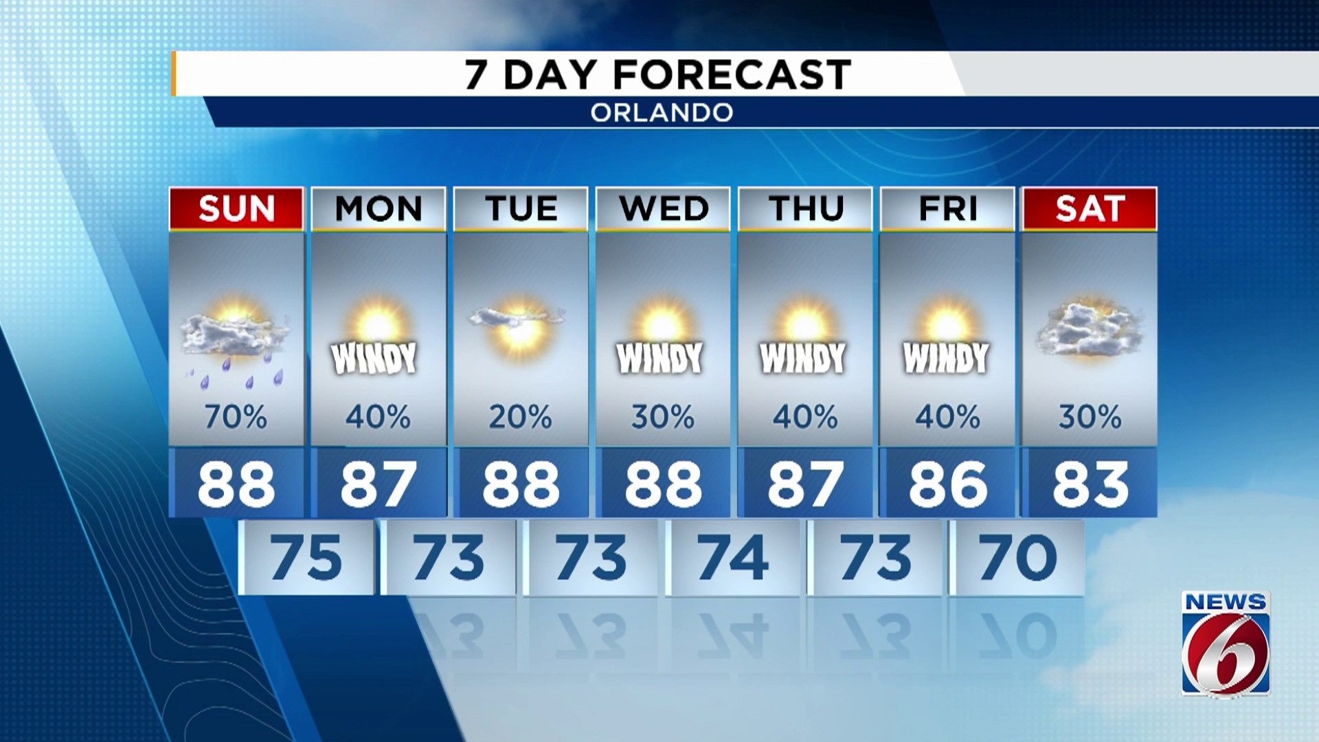
This evening, the storms are beginning to calm down, with lingering showers in northern and eastern Florida. While lightning may persist into early Sunday morning, no severe weather is expected at the start of the day.
Once we start rolling into the warmest parts of the afternoon, rains will ramp back up quickly as we tap into two moisture sources.
The front in question will start to lose some of its momentum. Consequently, moisture from the west will continue to flow, meeting easterly winds from the Atlantic, influenced by tropical depression 9.
The worst conditions won’t fully be realized until Monday, just in time for the start of the new work week.
However, tomorrow will definitely be pretty rainy and stormy, starting with our eastern counties and rolling westward into the early evening hours.
Heavy pockets of rain might lead to flash flooding. Tonight, isolated but intense rain showers are still passing through Marion County, where the National Weather Service has issued a flood warning.
Tomorrow, similar conditions could arise as tropical rains converge with the stationary boundary, possibly resulting in more instances of flooding.
With the increased moisture, expect lots of cloud cover tomorrow, keeping temperatures in the mid-to-upper 80s, similar to today. However, rising humidity levels will make it feel hotter.
Then as we start to see the approach of Tropical Depression 9 – soon to be a tropical storm Imelda – our winds will ramp up late Sunday and through the day on Monday. We have tropical storm watches issued up and down the eastern seaboard of Florida, and we’re carefully watching if/when National Weather Service decides to upgrade to tropical storm warnings, which could occur as early as tomorrow.
Copyright 2025 by WKMG ClickOrlando – All rights reserved.