
Share this @internewscast.com

HOUSTON (AP) — For the millions of Americans residing in coastal regions, hurricane season is often a period filled with anxiety, as these storms bring fierce winds and torrential rain that can lead to extensive damage, prolonged power outages, and major disruptions to daily life.
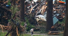
Meteorologists anticipate an exceptionally busy hurricane season in the Atlantic, forecasting between six to ten hurricanes, with up to half potentially escalating to major hurricane status.
Emergency management experts suggest that the anxiety surrounding hurricane season can be lessened with adequate preparation. Developing a strategy for fortifying homes and deciding whether to stay or evacuate in the event of a storm is crucial. This preparation, which involves assembling a kit of vital supplies, should be undertaken well before any storm threat looms on the horizon.
“Don’t be complacent, take preparedness seriously, spend the time now to do the little things that will make a big difference for you and your loved ones when something does happen,” said Brian Mason, director of Houston’s Office of Emergency Management.
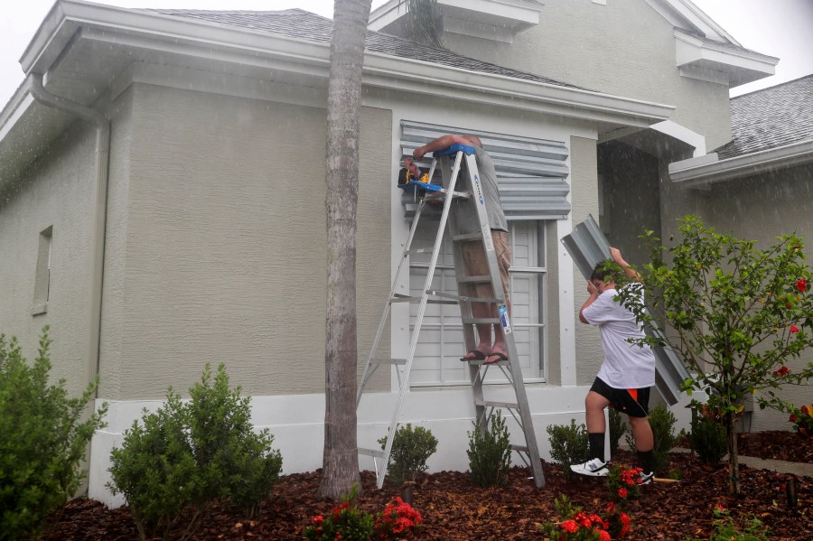
How to prepare a home for a storm
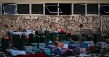
Anything in the backyard that isn’t tied down, such as furniture and barbecue grills, should be secured or brought inside so it doesn’t become a flying projectile that can come through a window, said Shawn Schulze, regional CEO for the American Red Cross Texas Gulf Coast Region.
If possible, board up windows and place important documents such as passports and birth certificates in a waterproof case or even a Ziploc bag, Schulze said. That will prevent damage and make documents easier to locate in a quick evacuation.
Mason recommends that homeowners get their roofs inspected before each hurricane season and know how to turn off their utilities in case of damage.
Well before a storm is brewing, people should trim or remove dead or weakened tree limbs and shrubs that hang over their homes to lessen potential damage from high winds, said Mistie Hinote, a spokeswoman for the Texas Department of Insurance.
Hinote also urged people to review what type of insurance coverage they have and to make a home inventory of their possessions by taking photos of them in case an insurance claim needs to be made after a storm.
“It is a lot of information and a lot of pre-storm steps but a little at a time,” Hinote said.
Have an emergency kit
Every family should have an emergency kit with supplies to meet its basic needs.
For people who stay, a kit should include at least 1 gallon (3.8 liters) of water per day per person, with enough for up to seven days, Mason said. One way to have enough water is to fill a bathtub.
People should also have enough nonperishable food for up to seven days, as well as flashlights, batteries, candles, medications, portable power banks or other power sources, and a radio that runs on batteries.
Pets should be included in preparations, including bringing them inside ahead of a storm, and having enough food, water and necessary medications for up to seven days, Mason said.
Parents should also include something to entertain their kids, such as games or coloring books, because likely power outages after a hurricane mean there won’t be internet and cellular service, and there’s “nothing’s more challenging for a family than kids that are bouncing off the walls because they’re bored,” Mason said.
“If you decide to stay, you need to make sure that you can be self-sufficient for days to weeks, depending on how long it takes for power to be restored,” Mason said.
Have an evacuation plan
If people decide to leave ahead of a storm, they should also prepare an emergency kit with enough supplies to get to their destination, officials said.
Before a storm arrives, people should know their evacuation routes are and have backup routes in case roads get congested, Mason said.
Officials recommend fueling vehicles if a storm is approaching. People with electric vehicles should make sure their routes have charging stations along the way, he said.
Schulze said it’s natural for people to be afraid when a hurricane is coming, but having a plan in place and letting loved ones know you’re prepared will go a long way to easing fears.
“Think about what the worst could be and prepare for that and you’ll always be ready for what comes your way,” Schulze said.
___
Follow Juan A. Lozano: