Share this @internewscast.com
TAMPA, Fla. (WFLA) — One more hot, muggy and dry day before changes arrives to Tampa Bay.
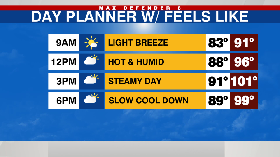
Feels like temps this afternoon will be back in the triple digits for many. Outside of a stray inland shower late this evening it will stay dry.

A cold front is expected to move in and pass through on Thursday, potentially bringing some scattered showers and maybe a thunderstorm. A few showers might occur along the Nature Coast during the morning, gradually shifting southward throughout the day.

By evening, the humidity will decrease and this change will be noticeable. This slightly reduced humidity will last until Saturday morning, after which it will rise again for the remainder of Memorial Day Weekend.

Temperatures will also increase this weekend with highs in the mid-90s, approaching records, and feels like temps up to 105 degrees.

Rain chances will stay in the forecast as well. Not a weekend washout but scattered showers are possible each afternoon.