
Share this @internewscast.com
The Northern Territory’s temporary respite from the first cyclone of the season is likely to be short-lived, as Cyclone Fina is expected to regain strength, reaching category 2 status today, with the potential to escalate to category 3.
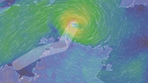
As of 9:30 pm local time (11 pm AEDT), the cyclone was unleashing peak gusts of approximately 100 km/h. The storm was moving south, positioned around 360 kilometers northeast of Darwin and 135 kilometers north-northeast of Minjilang, located on Croker Island.

Authorities have issued an initial flood watch for the north-west coastal rivers, anticipating a rise in creeks and rivers due to the expected heavy rainfall.
The city of Darwin has been placed under a cyclone watch, with warnings of potential gale-force winds on Saturday, likely starting later in the morning and continuing into the afternoon.
Experts note that the cyclone’s impact on Darwin will largely depend on its trajectory. Should the storm path remain close to the Tiwi Island coast, Darwin might experience lesser effects.
“If the track hugs the Tiwi Island coast, then the impacts will be less on Darwin.
“If the track moves closer to the mainland north Australian coast then Darwin is likely to see the impacts of the cyclone during Saturday.”
The warning zone covers Milikapiti to Maningrida, including the Cobourg Peninsula, Minjilang and Warruwi.
Forecasters warned of wind gusts up to 120km/h over the Cobourg Peninsula between Cape Don and Warruwi last night, with possible destructive winds up to 155km/h today in the same area as the system nears the coast.