
Share this @internewscast.com
Western Australia is on high alert as Tropical Cyclone Fina advances toward the Kimberley region, bringing with it winds approaching 200 km/h.
The cyclone has intensified to a severe Category 4 storm while traversing the Joseph Bonaparte Gulf, according to Jonathan How from the Bureau of Meteorology.
Currently, the storm’s impact is primarily over open waters, yet Fina is already exhibiting sustained winds of 185 km/h, with gusts near the center reaching an intense 260 km/h.
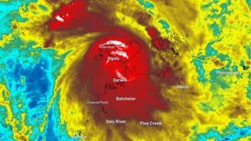
Located about 300 km southwest of Darwin, the cyclone is moving southwest at a speed of approximately 8 km/h.
A tropical cyclone warning is still active for the northern coast of Western Australia. Fina is anticipated to make landfall in the northeast Kimberley region either tonight or early tomorrow morning.
Though it is expected to weaken to a Category 3 storm before landfall, gusts between 120 km/h and 185 km/h are likely to occur post-landfall, as noted by How.
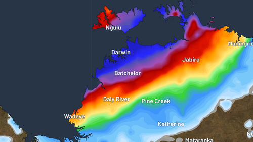
Local “heavy to intense” rainfall, along with possible flash flooding, is also expected along the northern Kimberley coastline.
Cyclone warnings have been lifted in the Northern Territory, but flood warnings remain in place for the affected catchments.
Falls of up to 140mm have been recorded near Darwin, while a severe whether warning for heavy rain is in place for the Daly district.