Share this @internewscast.com
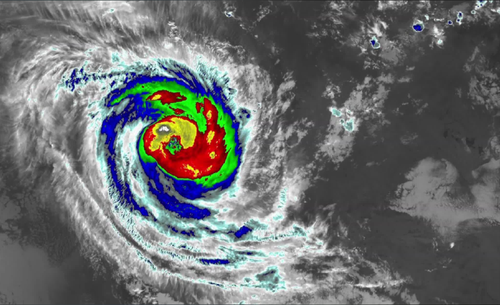
The cyclone has intensified once more, regaining strength as a Category 3 storm, and is now unleashing wind gusts reaching speeds of up to 200 km/h along the Pilbara coast, as reported by the Bureau of Meteorology (BoM).
BoM’s senior meteorologist, Angus Hines, highlighted that the effects of the cyclone are already making their presence felt and are expected to intensify as the weekend approaches.
“We’ve observed wind gusts reaching up to 144 km/h at Rowley Shoals offshore,” Hines noted.
“On mainland Western Australia, the most affected areas overnight have been Karratha, experiencing gusts up to 83 km/h, Roebourne with gusts of 81 km/h, and Port Hedland at 80 km/h.”
Hines also issued a warning that winds could escalate to 200 km/h today, raising concerns about potential structural damage.
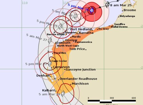
As the cyclone continues to gather strength and size throughout the week, the ultimate path of Cyclone Narelle remains uncertain.
One possible scenario suggests Narelle could cross Exmouth as a category 5 storm.
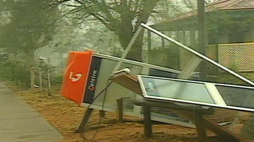
Cyclone Vance decimated Exmouth when it hit 27 years ago with 267km/h winds smashing the town.
History could repeat itself this weekend.
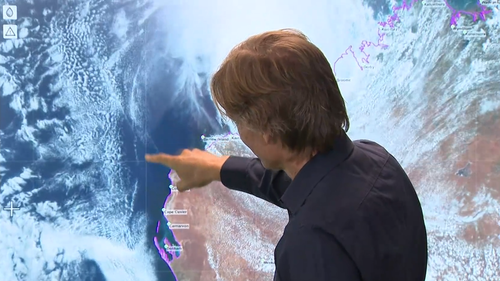
Narelle’s path is unpredictable. It could hit Exmouth as a category 5 but another forecast model suggests it might track further south and pass over Denham as a category 3.
Either way, Perth is set for a soaking.
“We’re expecting rainfall, even in Perth, of 50 millimetres to 100 millimetres over the course of Friday and Saturday,” Ashley said.
“So, regardless of the coastal crossing there will be significant rainfall.”
Hines this morning said by the time the system approaches Perth, it will have weakened into a tropical low, and while winds will be less intense, the city could still face impacts.
”This much rain around Perth, that’s enough to lead to areas of flash flooding,” he said.
“This will also put a lot of rain into the rivers around southwestern WA.”
A flood watch has been issued from the North West Cape all the way down to the Swan River in Perth.
A number of events across Perth this weekend have already been cancelled, postponed or relocated.
Ice Cream Factory in Northbridge is moving its outdoor event to RAC Arena.
“I think everyone rocking up to a concert and it being cancelled is just not an option for us,” organiser Chris Bausor told 9News.
“We value the trust that customers place in us by buying a ticket ahead of time, so moving it to RAC was the only option.”
Daryl Braithwaite at Ascot racecourse has been rescheduled but Scarborough Beach Weekender is forging on, with workers starting their set up today.
Rottnest ferries are still going ahead at this stage but the Island Authority is offering free cancellations on campground bookings and boat moorings.
Preparations get under way
WA Premier Roger Cook has asked locals to “heed the advice of emergency services”.
“We know you’ve got experience in dealing with cyclone events but they are unpredictable,” he said.
And it looks like some people are taking that advice, with towns in the north of WA beginning to prepare as Narelle gains strength off the coast.
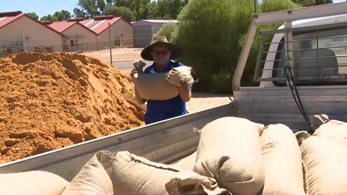
Kalbarri knows how devastating a cyclone can be after being smashed by Seroja almost five years ago.
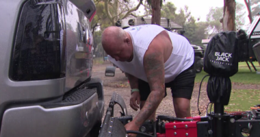
Taking no chances this time around, locals were stocking up on sandbags today.
Caravan parks in Kalbarri, as well as those further north in Denham and Exmouth, are evacuating travellers and turning away any new bookings.
Kalbarri locals spent the day tidying up and even with preparations in full swing, they’re hoping for the best.
“I think everyone is just waiting to see what happens, it’s an unknown if it’s gonna cross here or Carnarvon or Jurien Bay,” Graeme Cull from Kalbarri Tudor Holiday Park told 9News.
Mark and Janice Murrie lived through the category 3 cyclone in 2021 and they say locals are scarred.
“There will be a lot of stressed people here,” Mr Murrie told 9News.
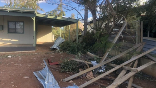
“‘Cause the mental health after the last one – people were just shell shocked.
“We were lucky cause we didn’t get a lot of damage – a lot of mess but not a lot of damage.”
Narelle getting stronger and more unpredictable
Right now for the people in towns dotted along the Mid West Coast it’s a waiting game as Narelle grows stronger and more unpredictable.
It will really ramp up later tomorrow, with very destructive wind gusts up to 260 km/h possible for west of Onslow, as the system moves closer to the North West Cape.
Those wind gusts could extend south to Carnarvon during Friday, which the latest mapping showing the area could take a direct category 4 hit.
Denham could see gusts of close to 200 km/h later on Friday.
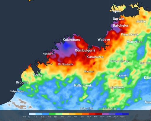
The system has already dumped huge rainfall totals, with 177 millimetres recorded in Cygnet Bay, north of Broome.
Narelle’s impacts will be felt in Perth on Friday and Saturday.
NEVER MISS A STORY: Get your breaking news and exclusive stories first by following us across all platforms.