Share this @internewscast.com
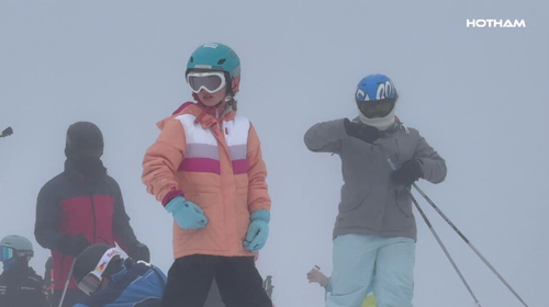
Australia’s alpine resorts are forecasting the best July snow conditions in recent years, following an icy front that covered the alpine regions with up to 15cm of snow overnight.
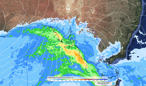
The strong cold front originating from WA moved across the south-eastern parts of the country, delivering rain and snowfall to Victoria and NSW, as reported by Weatherzone.
Mt Hotham locals woke to more than 10cm of fresh snow this morning after temperatures plunged to almost minus four degrees.
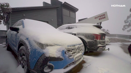
Heavy snow this evening is expected to bring another 20cm to 30cm of fresh snowfall by the morning, Mt Hotham’s Emily Smith said.
“It’s looking like a particularly snowy July. We have snow predicted for nine out of the next 10 days, which should establish the season quite nicely,” Smith stated.
“By the weekend, [we could see] up to 40 cm of snow.
“We’ve had a great start to the season and July is looking even better.”
Six centimetres of snow accumulated overnight at Mt Buller, with forecasters predicting sub-zero temperatures over the next couple of days will see that figure grow.
Falls Creek enjoyed 9cm of fresh snow, while 15cm coated Mt Baw Baw, bringing an average of 45cm on the runs.
The strong snowfall is expected to peak tomorrow, when a second powerful cold front moves across the mainland alpine region, Weatherzone said.
After receiving 10cm of snow overnight, Perisher is anticipating an additional 15cm to 30cm will top up the base tomorrow.
Tomorrow, Thredbo locals are in for a repeat of conditions today, where snow showers brought 12cm of fresh snow.
Ski resorts across Victoria and NSW are bolstering the fresh snowfall with manmade snow guns for optimum conditions across the school holidays.
While the conditions are welcome news for families travelling to the alpine region, the polar westerly is set to bring one of Melbourne’s coldest days of the year to date, with locals expected to shiver through a maximum of just 11 degrees tomorrow.
Conditions are expected to moderate in Victoria and NSW across the weekend.