
Share this @internewscast.com
The advisory indicated “La Niña conditions are prevalent and likely to continue through December 2025 – February 2026, with a shift to ENSO-neutral probable between January and March 2026.”
And it could be set to affect Australian weather.

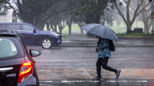
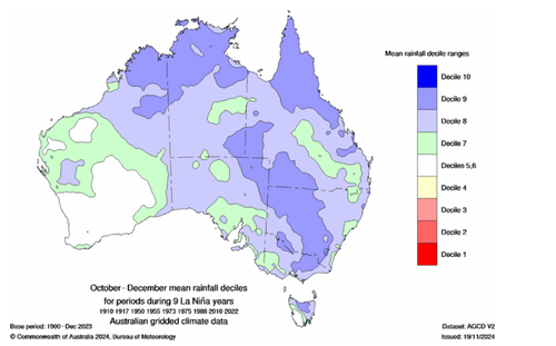
“Moderate-to-strong La Niña events during late spring and early summer usually increase cloudiness and rainfall and reduce daytime temperatures across vast regions of Australia, notably in the northern, central, and eastern areas,” stated Weatherzone.
“However, the influence of weak or borderline La Niña episodes is less predictable.”
Although Weatherzone experts mention a La Niña-like pattern is currently present in the Pacific Ocean, it is expected to be short-term and relatively mild.
That means it may not have a strong influence on Australia’s weather in the coming months.
Other climate drivers are expected to have a bigger effect, including abnormally warm sea surface temperatures closer to Australia
Due to climate change and the swift warming of oceanic waters, the Bureau of Meteorology has updated its analysis of the principal weather patterns: El Niño and La Niña.
The former brings warmer conditions while La Niña leads to increased cloud and rain.
Both weather patterns are influenced by sea temperatures in the tropical Pacific Ocean.
La Niña is a natural climatic occurrence characterized by cooler than normal water temperatures in the equatorial Pacific, impacting upper atmospheric patterns — these combined factors affect global weather.
Meteorologists closely observe La Niña and its counterpart El Niño because they tend to influence weather in a predictable and consistent manner, especially when these patterns are intense.
They exert the most influence during winter in the Northern Hemisphere, but that sway fades during other seasons, allowing other atmospheric influences to seep in.
The upcoming La Nina looks to be on the weaker end of the spectrum, which could also affect how clear-cut its influence becomes.