
Share this @internewscast.com
The unpredictable nature of this weather phenomenon posed significant challenges for forecasters.

(9News)
Earlier this week, the Bureau of Meteorology (BoM) had alerted residents about the possibility of severe thunderstorms bringing heavy rainfall to Gippsland, along with potential downpours over the Otway Ranges.
In a dramatic turn of events, Mt Cowley in Lorne reported an astonishing 45mm of rain within just one hour yesterday morning.
Reacting swiftly, the BoM issued a severe thunderstorm warning, cautioning about heavy rainfall that could result in flash flooding. This warning was quickly extended to encompass the Surf Coast area.
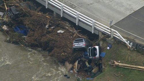
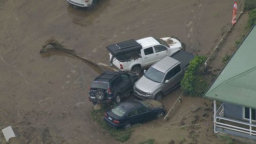
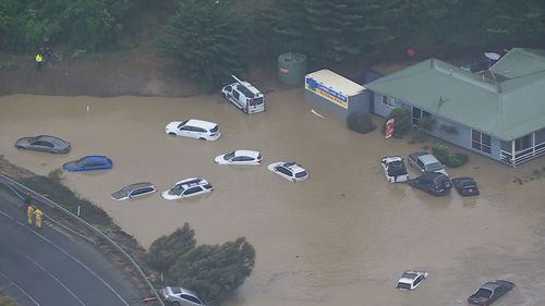
Subsequently, an intense deluge unleashed 180mm of rain in under five hours, triggering flash floods in Wye River, Kennett River, Cumberland River, and Lorne.
The torrential rainfall shattered records in several locations.
Roads flooded, cars and caravans were swept away, and at least one person had to be rescued from a roof.
The immediate flash flooding threat has passed but clean-up efforts will likely drag on for days.
Professor Andrew Western, chair of hydrology and water resources at the University of Melbourne’s Faculty of Engineering and Information Technology, said he wasn’t surprised that warnings for the flash flooding came so last-minute.
“First of all, rainfall predictions are really hard, especially the sort of events that led to these floods,” he told 9news.com.au.
“These were really big rainfall events, like we’re talking somewhere vaguely in the one in 100-year probability levels … so predicting that size rainfall event is super hard.”
The second contributing factor was that the downpour fell over small catchments in the Otways, which tend to respond rapidly to brief, intense rainfall.
Where larger rural catchments can handle longer periods of rain before flooding, small catchments can spill over in a matter of hours during intense rainfall.
That makes it difficult for the BoM or emergency services to predict flash flooding in small catchment areas ahead of time.
Eadie said much the same today.
”With small catchments, you tend to get very little warning,” Western said.
In 2011 the tiny town of Grantham, in Queensland’s Lockyer Valley, was hit by a sudden and devastating flash flood that claimed 12 lives.
There were no reported deaths from the flooding in Victoria yesterday and dramatic flood events like it remain relatively rare in Australia.
But global warming could change that.
Climate change has made Australia’s weather more volatile and contributed to extreme weather events on both ends of the spectrum, from cyclones to bushfires, which often occur in quick succession.
Earlier this month, Central Queensland was ravaged by ex-cyclone Koji, which left entire towns underwater.
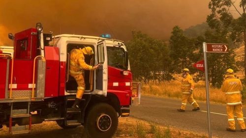
Meanwhile, 10 major bushfires are still burning in parts of Victoria, where horror blazes have damaged or destroyed more than 1000 structures, including almost 300 homes.
These extreme weather events are becoming more common, making it harder for forecasters to accurately predict what will come next when Australia’s weather no longer behaves the way it did in the past.
For the time being, Western encouraged all Australians to research their local flood risk and what to do in an emergency situation.
”Flood events are things that only happen occasionally, so they tend to be a surprise to people because people are not very informed about their local risks,” he said.