Share this @internewscast.com
An extensive storm system is sweeping across the Southern and Eastern United States, placing millions of Americans under tornado watches.
This powerful weather phenomenon has already unleashed over a foot of snow from the northern Rockies to the Great Lakes. Meanwhile, in the southern regions, gusts reaching up to 75 mph have resulted in widespread power outages, affecting hundreds of thousands.
The National Weather Service’s Storm Prediction Center has highlighted a significant threat of tornadoes developing across nine states, with warnings impacting more than 12 million people by Sunday evening.
Instagram influencer Sarah Krafft shared a video Sunday evening showing the storm approaching her home in Missouri as ominous, dark clouds formed on the horizon.
In a video shared from the storm’s core, a resident remarked, “Today, we’re facing a tornado warning alongside a wind advisory, with winds akin to a hurricane, and snow is on the horizon…”
She noted, “The radar showed a striking red line heading directly towards us, placing us right in the center of the tornado warning zone.”
Subsequently, in the video, Krafft and her husband decided to seek shelter at his parents’ home to avoid the impending tornado threat. She mentioned that the temperature had plummeted to 15°F.
Parts of Arkansas, Missouri, Mississippi and Tennessee are at the highest risk of tornadoes forming, and there is also risk in parts of Illinois, Indiana, Ohio, Kentucky and Georgia.

Millions of Americans are under tornado watches as an enormous storm rages across the South and eastern portion of the United States

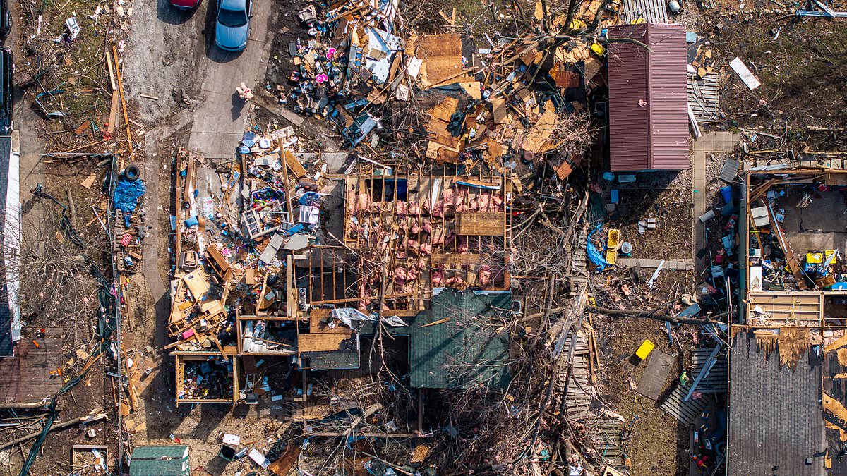
Some of the potential tornadoes are expected to cause EF2-level damage, which means wind gusts up to 135mph could tear roofs off of houses and lift cars in the air. A home destroyed by a tornado in Illinois earlier this month is pictured
Meteorologists have said the storm is drawing moisture from both the Pacific Ocean and the Gulf of Mexico, creating a volatile combination of rain, wind and rapidly changing temperatures.
The tornadoes could potentially cause significant damage, and some are predicted to be categorized as EF2s or higher on the Enhanced Fujita Scale, which is a way of estimating tornado wind speeds based on damage.
Tornadoes at that level bring gusts of 111-135mph that are capable of tearing the roofs off homes, snapping trees in half and lifting vehicles into the air.
A level four of five risk of severe thunderstorms has been put into place for Monday from the Carolinas to the Maryland-Pennsylvania border. The surrounding area is under a level three of five risk.
As the storm moves east on Monday, the risk of tornadoes and severe thunderstorms will become highest in parts of Maryland, Virginia, North Carolina and South Carolina, according to the National Weather Service’s Storm Prediction Center.
Travel chaos has already emerged across the Midwest, with thousands of flights delayed or canceled at major hubs including Chicago and Minneapolis.
At O’Hare and Midway international airports in Chicago, more than 850 flights have been canceled, and at Minneapolis-Saint Paul International Airport, more than 600 were cance
led.
Meteorologists warned flight delays and cancelations could climb higher through Monday night, with ripple effects spreading across major hubs including Chicago, Detroit, Atlanta, New York, Boston, Washington DC and Philadelphia.

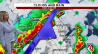
Parts of Arkansas, Missouri, Mississippi and Tennessee are at the highest risk of tornadoes forming. A severe storm warning map is pictured

The northern portion of the storm has already dumped more than a foot of snow in parts of southern Minnesota and central Wisconsin, with more expected to come. Snowfall in Wisconsin Rapids is pictured on Sunday
The northern portion of the storm had already buried parts of southern Minnesota and central Wisconsin in snow by Sunday morning, and snow is expected to continue in much of the Midwest and around the Great Lakes through Monday.
In Rochester, Minnesota, parts of the city have already recorded a foot of snowfall, and up to another foot of snow is expected by the time the storm ends. The city’s record snowfall was 20 inches in March of 2005.
Minnesota Governor Tim Walz has signed an executive order activating the National Guard to assist emergency operations as the storm intensified.
Parts of Michigan’s northern peninsula are expected to receive up to three feet of snow by Monday night.
The city of Marquette in that region may also experience record snowfall, as it is forecast to receive up to four feet. The city’s current two-day storm record is 32 inches of snow from a blizzard in March 1997.
In Maryland’s Baltimore County, all public schools and their offices will be closed early on Monday due to storm and tornado risks, the school district announced on X on Sunday.
Bob Oravec, a senior forecaster at the National Weather Service’s Weather Prediction Center, seemed to marvel at the extreme weather spreading across the country, which is causing varied severe conditions.
‘All of a sudden, Mother Nature is having a fit,’ Oravec said.