
Share this @internewscast.com
Millions across the United States are gearing up for a formidable snowstorm predicted to cover key urban areas in a thick layer of snow within mere hours.
Winter Storm Hernando is expected to sweep through the Northeast Corridor starting Sunday, potentially delivering up to two feet of snow to approximately 50 million residents, accompanied by wind speeds reaching 70 mph.
Authorities have cautioned that travel conditions could become “hazardous, if not impossible,” with the likelihood of power outages and fallen tree limbs due to the severe snow and wind.
Over 3,000 flights scheduled for Sunday and Monday have already been canceled, primarily affecting the Boston and New York City areas, as reported by major airlines.
The number of cancellations is anticipated to climb as snowfall commences, according to Fox Weather.
Residents in states such as Delaware, New Jersey, Connecticut, Rhode Island, New York, and Pennsylvania have been advised to prepare for icy weather conditions.
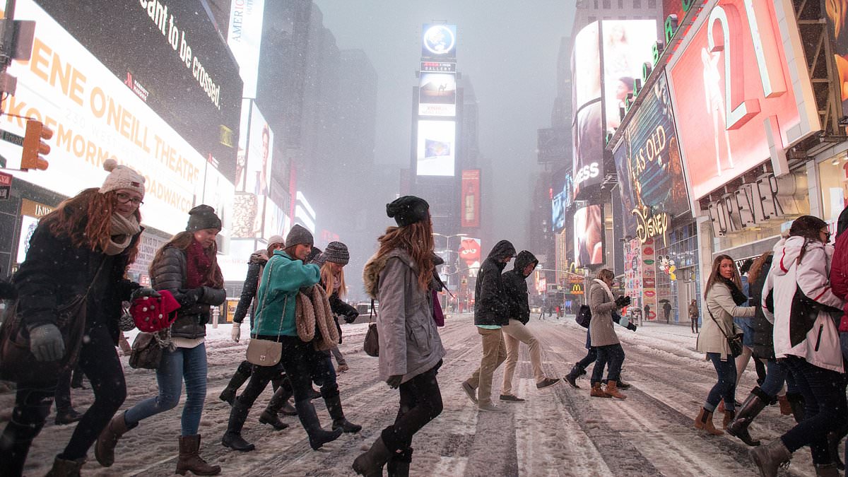
New York City is preparing for its first blizzard since 2017. A warning will be in effect for the city from noon on Sunday.
Meteorologist Owen Shieh told the Wall Street Journal the Big Apple had ‘lucked out in the last decade.’

New Yorkers are bracing for their first blizzard since March 2017 (pictured)

New Yorkers saw their last snow storm in January, but it was not classified as a blizzard

13 to 18 inches of snow were predicted to hit New York City, although the National Weather Service warned that could be more
Shieh offered a stern warning to New Yorkers ahead of the weekend’s storm.
‘You don’t want to be outside,’ Shieh said. ‘You won’t be able to see in front of you.’
During the last blizzard in March 2017, New York City saw more than a foot of snow accumulation and wind gusts up to 60mph.
Delaware residents were encouraged to travel in ’emergencies only’ as some Pennsylvania counties issued state of emergency warnings.
Boston will see its first since 2022 through 7am on Tuesday.
Southern Delaware and the Jersey Shore can expect blizzard conditions beginning on Sunday. Snow could accumulate up to 24 inches, reported CBS.
New Jersey Gov. Mikie Sherrill declared a state of emergency starting noon Sunday ahead of what she called a ‘severe’ storm.
Washington DC and Philadelphia are forecast to be hit before the storm eventually reaches New York, with snowfall beginning as early as 7am on Sunday.

Delays were expected at regional airports in wake of the snow storm, with New York City authorities already warning that cancellations and delays were typical after blizzard condition

Temperatures will peak back up at 40F by midweek, allowing the snow accumulation to melt

New York City will deploy 2,200 snow plows in its first blizzard in almost a decade
New York Governor Kathy Hochul declared a state of emergency for the Big Apple, Long Island and portions of the Hudson Valley.
In the city, where the heaviest snowfall is expected, accumulations could begin from 7pm Sunday and last to noon Monday, per the National Weather Service.
Mayor Zohran Mamdani warned New Yorkers to stay off the roads unless it was ‘absolutely necessary.’
‘If you can stay home, stay home,’ he wrote.
The city will deploy 2,200 snow plows, hundreds of shovelers and employees to combat snow accumulation.
Fortunately, this time around temperatures in most places are forecasted are expected to skyrocket to the 40s by mid-week, melting the snow inevitably piled up on sidewalks.
Forecasts predict the system’s pressure to intensify rapidly, forming what is known as a bomb cyclone or an Arctic hurricane.
While much of the US was walloped by an intense winter storm in January, snowfall can only be classified as blizzard conditions if wind speeds are above 35mph.