Share this @internewscast.com
The United States and Israel have embarked on an exceptionally aggressive military campaign, significantly heightening tensions with Iran and fueling concerns about a potential escalation into a broader conflict.
With the threat of retaliation looming, a stark new analysis prompts Americans to consider a terrifying scenario: the ramifications of a nuclear attack on American soil should the conflict escalate uncontrollably.
To provide a clearer picture of this threat, a recently shared map illustrates the possible consequences of a large-scale nuclear strike, highlighting how major urban areas across the nation could be affected.
The analysis suggests that if pivotal cities on the East Coast, West Coast, Midwest, and South were hit, up to 250 million Americans—approximately 75 percent of the population—could perish.
The projection indicates that extensive regions of California, the majority of the Eastern Seaboard, and crucial parts of the Midwest could be shrouded in intense radioactive fallout.
People in these affected areas would need to remain in shelters for over three weeks to evade deadly radiation. In contrast, only portions of western Texas, select areas of Nevada, and regions in Michigan and Wisconsin might escape immediate devastation from the initial blasts.
But even those regions could become uninhabitable in the nuclear winter that scientists warn would follow a large-scale exchange.
The map was developed using modeling data from the Federal Emergency Management Agency (FEMA), incorporating projected blast radii, fallout dispersion patterns and radiation exposure levels based on likely detonation points and population density.

The map reveals the devastation of a large-scale nuclear war on the US, showing civilian, military and infrastructure that would likely be targets

The map comes as the US and Israel have launched one of their most aggressive military operations on Iran in decades
Trump has said repeatedly that Iran can never have a nuclear weapon.
He claimed to have ‘obliterated’ Iran’s nuclear program in strikes last June, but said this week that Tehran had attempted to rebuild the program.
‘Just imagine how emboldened this regime would be if they ever had and actually were armed with nuclear weapons as a means to deliver their message,’ he said on Saturday.
However, Western powers say there is no credible civilian justification for Iran’s enrichment of uranium to the levels it has produced, and the IAEA has said it is of serious concern. No other country has done so without eventually producing nuclear weapons.
While Iran does not have a nuclear arsenal, analysts warned that any escalation involving nuclear-capable states could have catastrophic consequences far beyond the Middle East.
To illustrate the potential impact on the US, the map has modeled what a large-scale nuclear strike on American soil might look like, highlighting the areas and populations most at risk.
The map, created by Halcyon Maps, a design project that creates detailed maps on various topics, shows that fallout would rapidly spread across the nation, transforming targeted cities into entire affected regions. Millions would be at risk of death from radiation.
The symptoms depend on the dose a person receives, but would include nausea, fatigue, vomiting, diarrhea, skin damage, seizures and even coma.

Every populated city on the East Coast, Midwest, West Coast and South would be targeted, killing up to 250 million Americans – about 75 percent of the country’s population
At high enough doses of penetrating radiation, these symptoms can start within minutes and can be deadly.
Major metropolitan cities like New York, Los Angeles, Philadelphia, Houston and Washington DC would likely be hit first.
That is because losing such cities would cripple the US economy, leadership and workforce.
Severe fallout will spread from Boston to New York City, Philadelphia and Chicago, engulfing millions of Americans in radioactive debris.
The hazardous areas are also found along the California coast and near military establishments.
Around these severe areas are medium zones, where people would have to shelter for up to three weeks.
The map shows minimal fallout would hit Georgia, Mississippi and Arkansas, suggesting residents would not have to shelter.
The US has strategically positioned nuclear forces that could be prime nuclear targets across the nation.
Not only does that include ICBM silos, but also naval and air force bases and nuclear storage depots scattered across the country.
Military targets are highlighted with red circles, with the largest clusters appearing where the silos are.

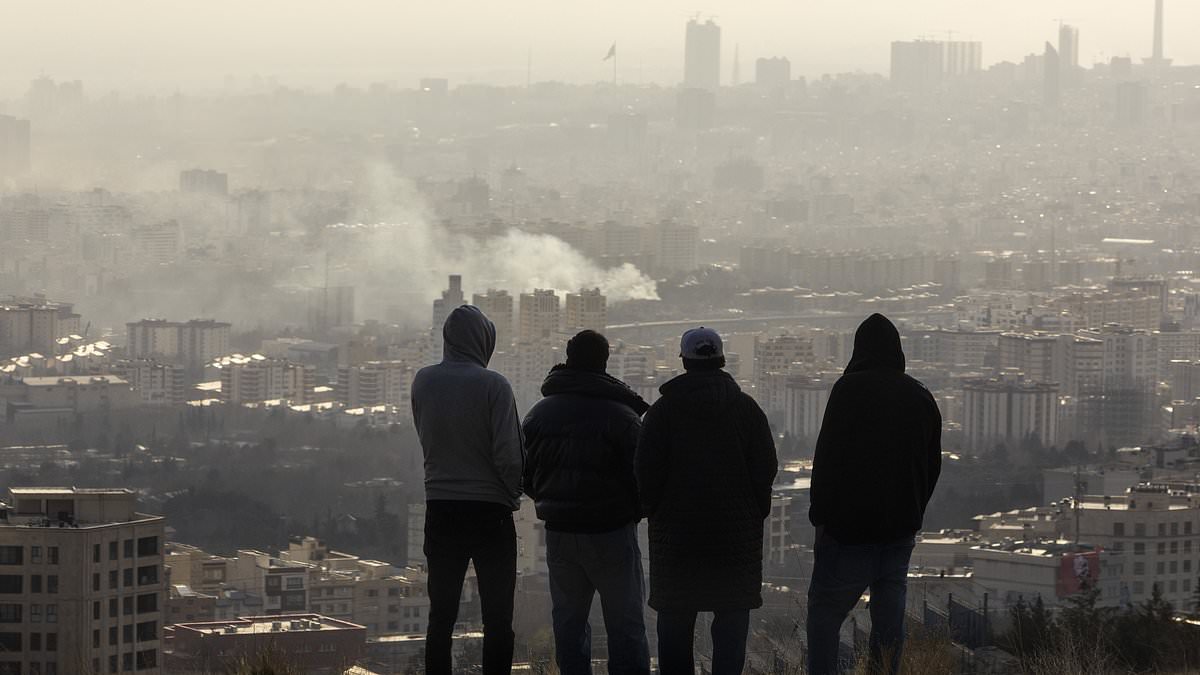
Men watch from a hillside as a plume of smoke rises after an explosion on March 2, 2026 in Tehran, Iran
John Erath, the Senior Policy Director for the Center for Arms Control and Non-Proliferation, told Newsweek: ‘While those who live near military facilities, ICBM silos in the Midwest or submarine bases along the coasts might bear the most immediate and severe consequences of a nuclear attack, there’s no question: Any nuclear war or weapons detonation would be bad for everyone.
‘Nowhere is truly ‘safe’ from fallout and other consequences like contamination of food and water supplies and prolonged radiation exposure.’
In addition to densely populated cities, more than 100 military facilities would likely be prime targets, including those where Intercontinental Ballistic Missile (ICBM) silos are housed.
These silos are located in Montana, Colorado, Wyoming and North Dakota, and the map shows these regions bombarded by nukes.
Infrastructure like power plants, transportation hubs, oil refineries and critical communication centers would also be under attack if bombs were dropped.
Scientists have speculated that the 450 ICBM silos would serve as the epicenters in a nuclear attack due to their being critical for America’s defense.
But the new map shows attacks from all sides of the country, hitting around 150 military sites.
That would include the North American Aerospace Defense Command (NORAD)in Colorado, the Pentagon and naval bases in California and Washington.
Texas, California and the Midwest show a high concentration of infrastructure targets, represented as yellow circles.
The Mississippi River region also has multiple infrastructure targets, possibly for disrupting transport and commerce.