
Share this @internewscast.com

The Storm Team 11 forecast calls for scattered showers and thunderstorms at times for Father’s Day weekend.
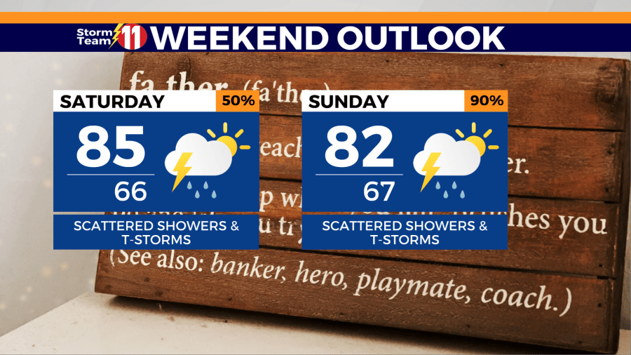
Saturday will be largely cloudy, with a 70% likelihood of scattered showers and thunderstorms. The temperature will peak at 84 degrees. During the night, scattered showers and a few thunderstorms are possible, with a low of 65 degrees.


On Father’s Day, expect more showers and thunderstorms amid mostly cloudy skies. The probability of rain on Sunday is 80%, with a high of 82 degrees. Showers and a few thunderstorms will persist into Sunday night, with a low of 66 degrees and cloudy conditions.


The rainy trend continues into the early part of the week, with a 50% chance of scattered showers and thunderstorms on Monday. The high temperature will reach 84 degrees. Monday night will likely be mostly cloudy, with a slight possibility of showers and thunderstorms.

Tuesday will be mostly cloudy with a 60% chance of scattered showers and thunderstorms. The high will be 84 degrees. A chance of scattered showers and thunderstorms is possible Tuesday night with a low of 66 degrees.

Wednesday stays unsettled with a 50% chance of scattered showers and thunderstorms. Skies will be mostly cloudy with a high of 86 degrees. A few showers and thunderstorms are possible Wednesday night with a low of 66 degrees.

Rain and thunderstorms become slightly more widespread by Thursday under mostly cloudy skies. The rain chance will be 60% with a high of 85 degrees.

Summer officially arrives late next Friday at 10:42 pm. Friday morning will feature a 30% chance of lingering showers, with sunshine expected throughout the afternoon. The high will be near 84 degrees.
Have a great morning!