
Share this @internewscast.com
CHICAGO – A sweeping band of snow descended on the Chicago area early Wednesday, complicating the morning commute with slick and hazardous road conditions.
The National Weather Service has issued a Snow Squall Warning for Jasper and Newton counties in northwest Indiana, which will remain in effect until 10 a.m. However, the warning has been lifted for southeastern Cook County, northern Kankakee County, and Will County in Illinois, as well as Porter County, Lake County, and northern Jasper County in northwestern Indiana.
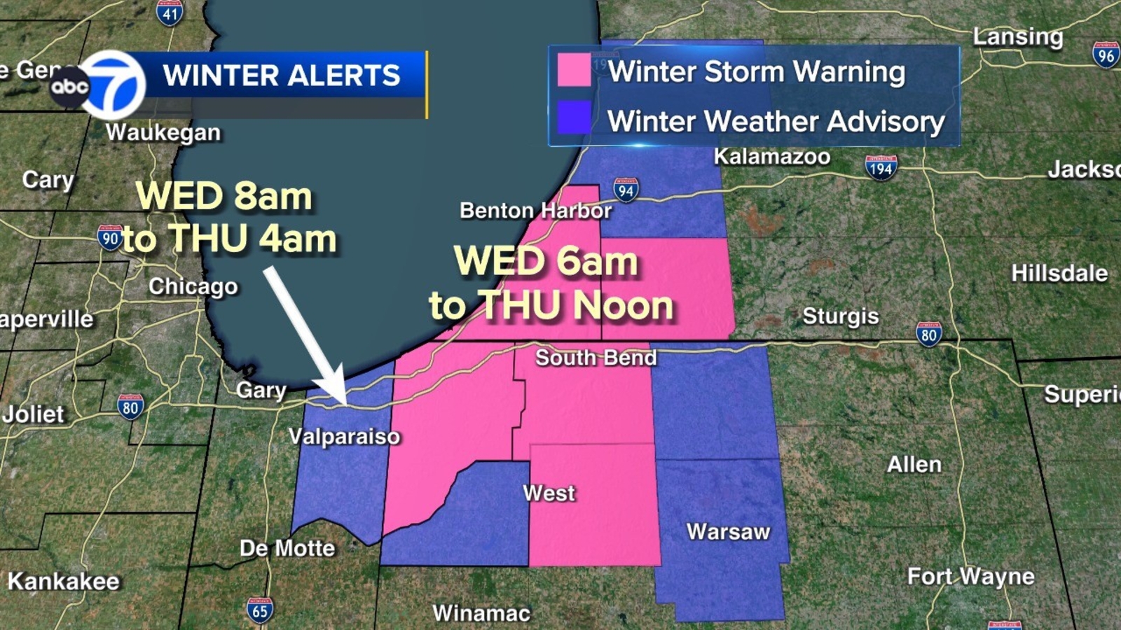
Additionally, a Winter Storm Warning is active from 7 a.m. ET Wednesday through 1 p.m. ET Thursday for La Porte County, Indiana, and Berrien County, Michigan.
ABC7 Chicago is now streaming 24/7. Click here to watch
Porter County, Indiana, is under a Winter Weather Advisory from 8 a.m. Wednesday until 4 a.m. Thursday.
Starke County, Indiana, also faces a Winter Weather Advisory from 7 a.m. ET Wednesday until 1 p.m. Thursday.
Heavy snowfall is anticipated Wednesday afternoon, with forecasts predicting between 2 to 5 inches in Porter County. In contrast, areas of La Porte and parts of Berrien could receive more than 6 inches, according to ABC7 Chicago meteorologist Tracy Butler.
Snow will continue through Wednesday night into Thursday morning before tapering off during the day on Thursday.
A band of snow began to move through the Illinois part of the Chicago area around 7 a.m. Butler said
The conditions led to a ground stop for arriving planes at O’Hare.
Temperatures across the area will drop steadily throughout the week.
Cook County Radar | DuPage County Radar | Will County Radar | Lake County Radar (IL) | Kane County Radar | Northwest Indiana Radar
Copyright © 2026 WLS-TV. All Rights Reserved.