
Share this @internewscast.com

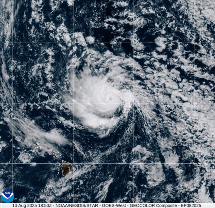
In the central Pacific Ocean, Tropical Storm Henriette quickly intensified into a hurricane on Sunday, as reported by the National Hurricane Center. Fortunately, it is not expected to impact any land areas.
Based in Miami, the center noted that the storm was approximately 445 miles (720 kilometers) to the north-northeast of Hilo, Hawaii, sporting maximum sustained winds of 80 mph (130 kph).
Henriette is moving northwest at a speed of 17 mph (28 kph), and it is projected to pass well north of the Hawaiian islands in the coming days. While the storm is forecasted to strengthen through Monday, it is anticipated to weaken by Tuesday.
The center identified Henriette as a compact tropical cyclone, with hurricane-force winds reaching up to 15 miles (30 kilometers) from its center.
In the Pacific, Tropical Storm Ivo was also on the move, situated roughly 470 miles (755 kilometers) west of Baja California’s tip in Mexico. It is forecasted to diminish into a remnant low by Monday, according to the hurricane center.
Currently, Ivo carries maximum sustained winds of 40 mph (65 kph) and is traveling west-northwest at 12 mph (19 kph), and no coastal watches or warnings have been issued.