
Share this @internewscast.com

MIAMI (AP) — Hurricane Kiko is projected to head towards Hawaii over the coming days, while post-tropical cyclone Lorena continues to drench Mexico’s Baja California peninsula with downpours, according to forecasters on Friday.
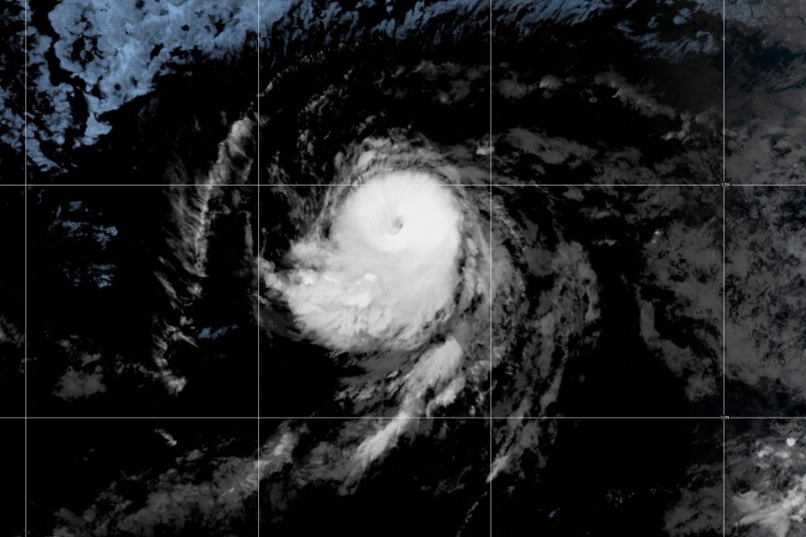
Kiko is currently classified as a Category 3 hurricane, though it remains a considerable distance from the Hawaiian Islands. The National Hurricane Center in Miami announced that it is premature to ascertain the precise impact or location it may have when expected to affect the 50th U.S. state around the midweek period.
According to a Friday morning update, Kiko’s center was located approximately 1,245 miles (2,000 kilometers) east-southeast of Hilo, Hawaii. The hurricane sustained maximum wind speeds of 115 mph (185 kph) and was moving west-northwest at 9 mph (15 kph).
Kiko’s strength would fluctuate over the next two days, forecasters said, before weakening by early next week.
No watches or warnings are currently active, but residents of Hawaii should stay updated on the hurricane’s developments. Forecasters predict that swells generated by Kiko might start reaching parts of Hawaii by the weekend’s close.
The hurricane center released its final public notice for post-tropical cyclone Lorena early on Friday. At that time, Lorena had sustained winds of 35 mph (56 kph) and was stationary roughly 170 miles (274 kilometers) west of Cabo San Lazaro, Mexico.
Lorena is anticipated to weaken further and dissipate by Sunday, as per the weather agency. Nonetheless, it could still result in isolated rainfall up to 12 inches (30 centimeters) in certain areas of Baja California Sur, Baja California, Sonora, and Sinaloa in Mexico. The threat of flash flooding and mudslides in these regions is predicted to persist through Friday night.
In Arizona and New Mexico, heavy rainfall of up to 4 inches (10 centimeters) was still possible and could lead to isolated flash flooding into Saturday, the weather agency said.