
Share this @internewscast.com

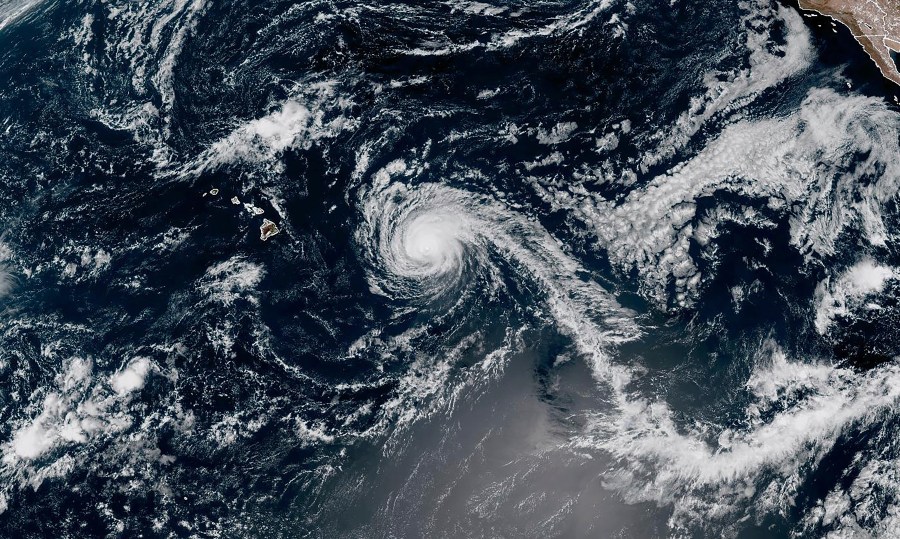
HONOLULU (AP) — A weakening Hurricane Kiko is anticipated to move north of Hawaii in the coming days, which should lessen the risk of strong winds and heavy rain for the islands. However, forecasters warned on Sunday that dangerous surf conditions could still occur.
Kiko was located about 635 miles (1,025 kilometers) east of Hilo on the Big Island as of Sunday and is expected to pass north of the islands on Tuesday and Wednesday, according to the National Hurricane Center in Miami. The hurricane was advancing west-northwest at a speed of 13 mph (20 kph).
The hurricane’s maximum sustained winds were recorded at 110 mph (175 kph) on Sunday, down from 120 mph (195 kph) on Saturday, with further weakening anticipated in the coming days due to cooler waters.
Currently, no coastal watches or warnings have been issued for Hawaii. Although the likelihood of direct impacts on the islands appears to be diminishing, the hurricane center advised residents to keep monitoring the storm’s progress.
Forecasters have cautioned that rip currents and surf on the islands’ east-facing shores could be hazardous, with waves reaching heights of 10 to 15 feet (3 to 4.5 meters) in certain areas.