
Share this @internewscast.com
Tropical Storm Imelda is predicted to gain strength and develop into a hurricane as it travels along the Southeast coast this week. This will result in hazardous surf, rip currents, coastal flooding, and beach erosion affecting areas from Florida to the Carolinas.
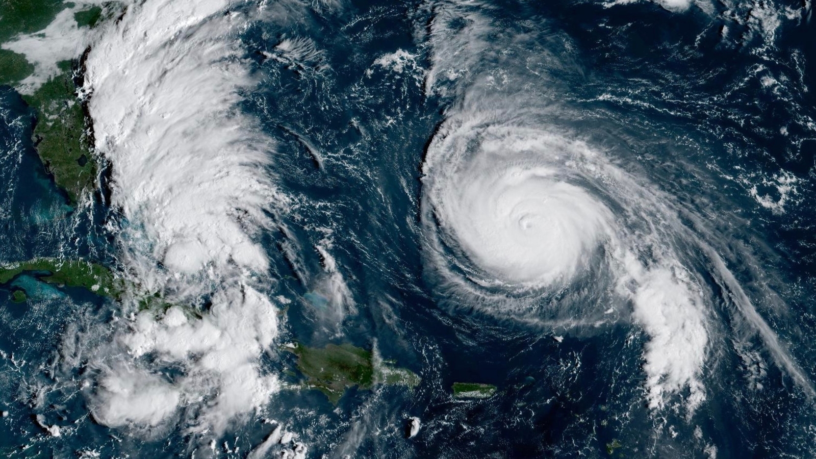
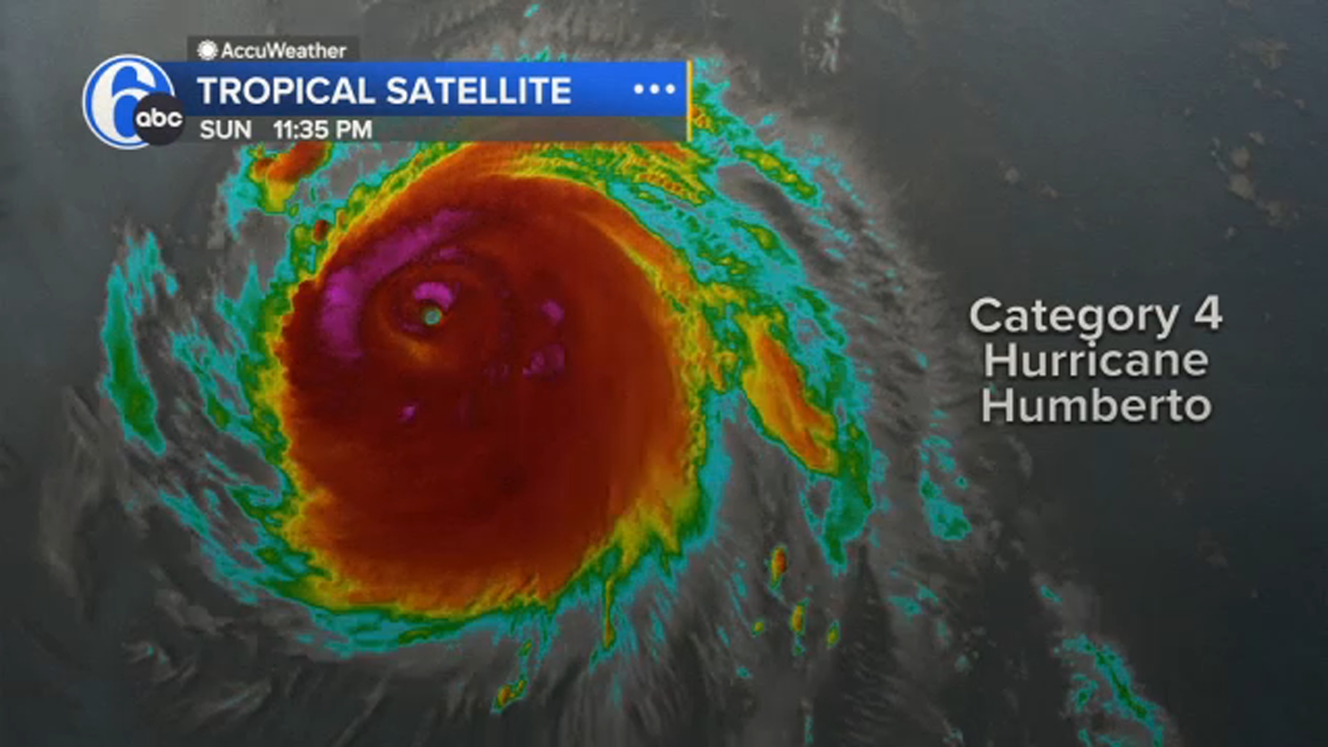
Meanwhile, Hurricane Humberto, which previously surged to a Category 5 hurricane with winds reaching 160 mph on Saturday, has now reduced to a Category 4. Its extensive circulation, located just east of Imelda, will exacerbate threats to U.S. beaches this week, intensifying deadly rip currents and causing large waves along much of the East Coast.
Although Imelda’s center is projected to remain far offshore, its extensive reach will still have a significant impact. Rainfall amounts between 2 to 6 inches are anticipated along the coastal Carolinas through Tuesday, heightening the risk of flash flooding. Coastal flooding could also occur from Florida’s Space Coast to South Carolina, where winds coming onshore might elevate water levels 1 to 2 feet above the usual dry ground during high tide.
RELATED: Tropical weather in the Atlantic is slamming the Caribbean and may strike Southeast US next
The Bahamas are currently dealing with Imelda’s strong winds and heavy rain. Tropical storm warnings continue for parts of the islands, with 4 to 8 inches of rain expected to cause flash flooding. A storm surge of 1 to 3 feet is also predicted, and eastern Cuba might experience an additional 2 to 4 inches of rain, leading to potential localized mudslides in mountainous areas.
As of early Monday, Imelda was producing maximum sustained winds of 45 mph and was located roughly 295 miles southeast of Cape Canaveral, Florida, according to the National Hurricane Center. The storm is expected to strengthen into a hurricane by Tuesday, as it moves parallel to Florida’s Atlantic Coast before sharply turning eastward into open waters.
Imelda’s slower-than-anticipated movement towards the north means that Humberto will dominate a tropical battle, steering Imelda away from the coast. “While the likelihood of significant wind impacts along the southeastern U.S. coast is decreasing, residents in the area should continually check for the latest forecast updates,” the hurricane center stated on Sunday.
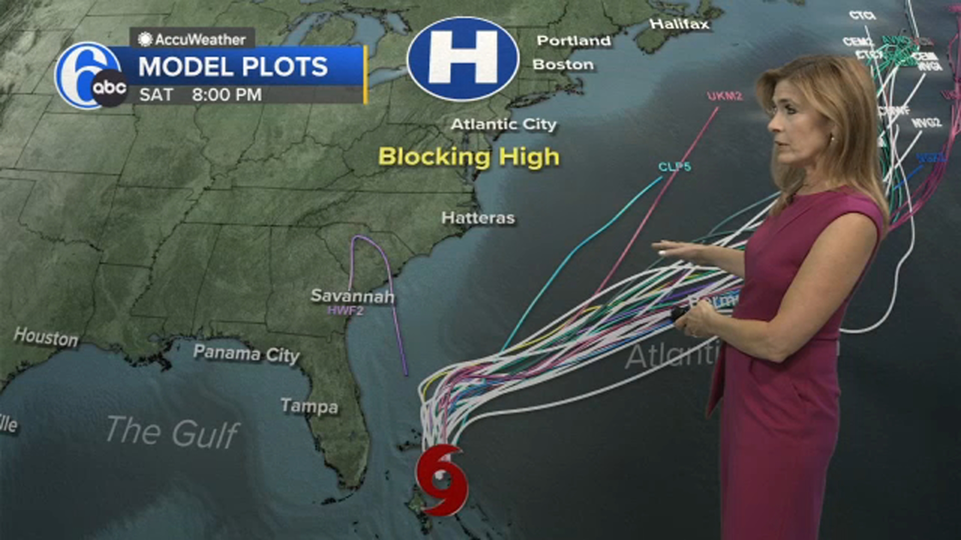
Officials in the Southeast geared up to deal with the storm even though things were looking less threatening Sunday. South Carolina Gov. Henry McMaster issued a state of emergency Friday, activating statewide response plans, while the City of Charleston declared a local state of emergency Saturday and began distributing sandbags and clearing storm drains ahead of potential heavy rain.
RELATED: Here’s what can happen when two hurricanes get too close together
Bermuda, meanwhile, faces a rare one-two punch. Humberto is expected to pass west of the island as a Category 4 storm Monday into Tuesday, bringing bands of rain, gusty winds and dangerous surf. The Bermuda Weather Service has issued a tropical storm watch for the archipelago.
On the heels of Humberto, Imelda could track even closer to Bermuda, with potential for a direct landfall Wednesday into Thursday. Two hurricanes in two days could deliver a punishing blow, even for the seasoned and storm-tested islands of Bermuda.
While the US may avoid a direct strike, millions along the East Coast will still feel the effects of Imelda and Humberto in the perilous surf, rain, gusty winds and coastal flooding this week.
So far this year, the US has avoided a direct hurricane landfall. Tropical Storm Chantal came ashore in South Carolina this July, but no storms have reached the coast at hurricane strength in 2025. If this streak holds, it would be the first season without a hurricane coming ashore in a decade.
Still, this season has been remarkable in another way: every hurricane so far – Erin, Gabrielle and Humberto – has reached major strength, a feat not seen this early since 1935. Rapid intensification has become far more common in recent years as the planet warms due to fossil fuel pollution.