
Share this @internewscast.com
As chilly temperatures descend and mix with a touch of moisture, some areas of the First Coast might witness a rare flurry this weekend.
JACKSONVILLE, Fla. — The highly anticipated moment has arrived: snow could make an appearance on the First Coast this weekend!
Just moments ago, I stepped out of an afternoon editorial meeting. After delivering my routine weather update, I wrapped up with my usual question:
One of my enthusiastic colleagues quickly raised a hand.
“My grandmother texted me, warning about a bomb cyclone near Florida. Is that really possible?”
Indeed, it is quite possible. For a detailed exploration, meteorologist Robert Speta provides an in-depth explanation in this article.
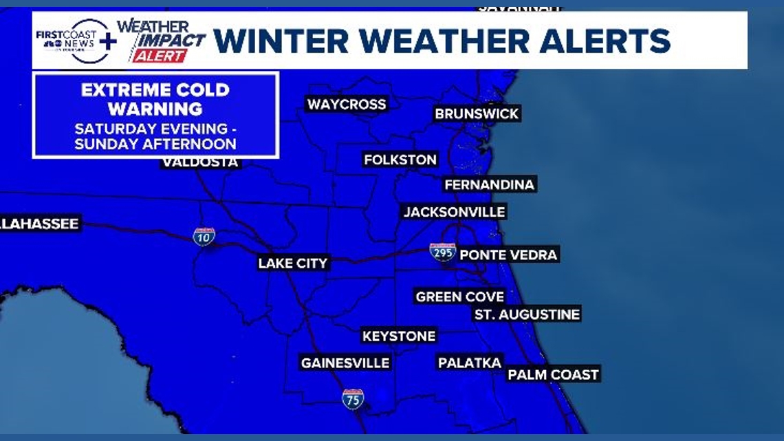
This area of low pressure is what is pulling in extremely cold air, the coldest in more than a decade, prompting a first-ever Extreme Cold Warning for our area. For perspective, the National Weather Service just started issuing Extreme Cold Warnings in 2024, replacing Wind Chill Warnings. The last time we had one of those was January 2014.
But you’re not here for all that, you are clicking on this headline for another reason, and another big question I’ve been getting a lot:
Will it snow on the First Coast this weekend?
Don’t get your hopes up for a 1989 event all over again, or even a 2025 event. Still, there is a possibility of seeing a flurry fly in parts of southeast Georgia and an even smaller chance of a flake or two being spotted along the coast of Nassau and Duval Counties.
Anywhere further south of that, well, no dice.
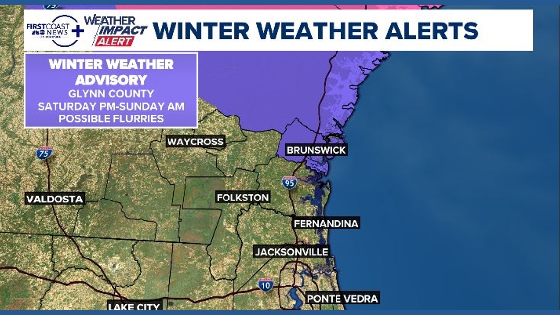
The National Weather Service has issued a Winter Weather Advisory for coastal and inland Glynn County due to the potential for a flurry, and our in-house forecasting model backs that up as well.
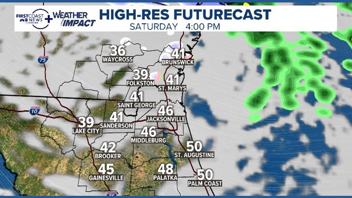
Here’s a look at midafternoon temperatures and simulated radar. You can see the brief snow signal in Glynn:


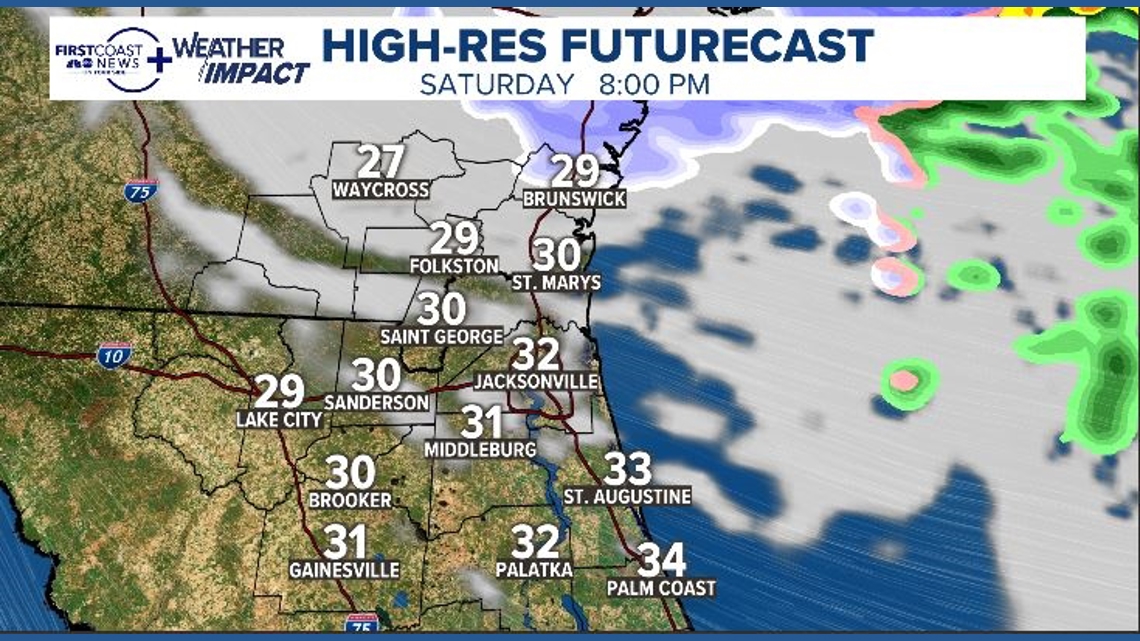
And here’s the same model run a few hours later, showing another band of wrap-around snow, propelled by the low off the coast of the Carolinas. This would be for 8 p.m. Saturday:

Another big takeaway from that model, which isn’t quite as catchy as snow but is even more important, is the temperatures and how quickly we get to freezing on Saturday.
Temperatures look to dip below freezing late afternoon Saturday and will stay below freezing until Sunday late morning. This means extra-long precautions will be needed for plants, pets, people and the pipes.
Be sure to protect exposed outdoor pipes, detach garden hoses from spigots, and make sure those hoses are drained. It’s not a bad idea to wrap outdoor pipes and even drip a faucet inside.
Temperatures on Sunday morning will plummet to around 20° inland, with some seeing the upper teens well inland. The beaches will even hit the mid 20s.
The winds are another part of the story. Gusts to 30 miles per hour will be likely on Sunday, so windchills will be in the single digits. This is a dangerous level of cold and can lead to frostbite or hypothermia.
Please take all precautions to protect yourself from the cold.