
Share this @internewscast.com
Tropical Storm Erin is predicted to become the season’s first hurricane within days.
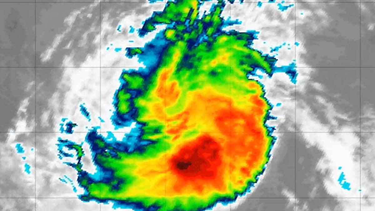
The National Hurricane Center (NHC) announced on Tuesday that the storm is advancing through the Atlantic Ocean at a speed of 22 miles per hour, heading closer to the US East Coast.
Experts predict that Erin is likely to become a hurricane by Thursday and could reach Category 3 strength by the weekend when it approaches nearer to the Caribbean.
Forecasters are concerned about a heightened risk of impacts along the East Coast this hurricane season due to the unusually warm waters north of the Caribbean Islands.
Nearly all recent spaghetti models indicate that Erin will remain over the ocean after passing near or to the north of the Leeward Islands, although a few tracks suggest it may curve northward, approaching closer to the US East Coast.
The forecast indicates regions like the Carolinas, the Mid-Atlantic, and parts of the Northeast might experience increased seas, surf, and rip currents, even if Erin remains offshore.
There is a slight possibility of it approaching more closely or making landfall, especially if the storm expands in size and strength, with tropical storm or hurricane conditions potentially extending over 100 miles from its center.
However, the NHC said it is still too early to determine what impacts, if any, Erin may bring to the northern Leeward Islands, Bermuda or the US East Coast.

Spaghetti models showed it curving northward along the US East Coast, with the potential for landfall or a close approach. However, officials said the exact path is currently unclear

Meteorologists said Erin is likely to develop into a hurricane by Thursday and reach Category 3 strength by the weekend, when it will be closer to the Caribbean
Craig Setzer, meteorologist and hurricane preparedness specialist, said on X: ‘In a few days, when Erin is over warmer water & less dry air, it should begin to strengthen.
‘The European model ensemble shows quite the spread in about 7 days as Erin begins a turn to the north, from east of Bermuda to near the Bahamas for possible tracks.
‘Until we see where Erin is and begins its turn northward in a few days, uncertainty in the models will likely remain high. In the USA, if we have our hurricane kits ready, just sit tight and keep an eye on things.’
As of Tuesday morning, the center of Erin was located about 750 miles west of the Cabo Verde Islands.
However, the storm unleashed deadly floods over the islands on Monday, killing seven people.
Municipal councilor Jose Carlos da Luz told a state broadcaster seven people had died in floods and one person was electrocuted, adding that three others were still missing.
The system is moving west through the Atlantic’s ‘main development region,’ which runs from Africa’s west coast to the Caribbean.
This zone, fueled by warm ocean waters, is where many tropical systems form as hurricane season reaches its peak weeks.

As of Tuesday morning, the center of Erin was located about 750 miles west of the Cabo Verde Islands

AccuWeather has predicted that dangerous sea and rip currents are set from Daytona Beach, Florida, up to Nantucket in Massachusetts
This puts Erin on track to become a Category 3 storm with winds as high as 115 mph by early Sunday, according to meteorologists.
At that point, the storm could be near or north of the Leeward Islands.
AccuWeather Lead hurricane expert Alex DaSilva said: ‘It is the shape of that oceanic high, as well as the approach of a cool front and dip in the jet stream near the Atlantic Coast, that will determine the exact track of the projected major hurricane as it approaches the Atlantic Coast of the US next week.’
AccuWeather has predicted that dangerous sea and rip currents are set from Daytona Beach, Florida, up to Nantucket in Massachusetts.
‘Families heading to Atlantic beaches before heading back to school should be cautious and stay in areas with lifeguards on duty,’ DaSilva said.
Elsewhere, Hurricane Henriette was a Category 1 storm in the central Pacific on Monday and was expected to retain hurricane status for another day or two before weakening.
Henriette had maximum sustained winds of 85 miles per hour, the NHC said. The storm was located about 595 miles northwest of Honolulu.
Also in the Pacific, remnants of onetime Tropical Storm Ivo degenerated on Monday about 615 miles west of the southern tip of Mexico’s Baja California peninsula. Forecasters said the remains of Ivo pose no threat to land.