Share this @internewscast.com
TAMPA, Fla. (WFLA) — The tropics are mostly calm as hurricane season gets off to a quiet start.
This year, Tracking the Tropics enters its seventh season, where our meteorology team will analyze the forecasted tropical activity.
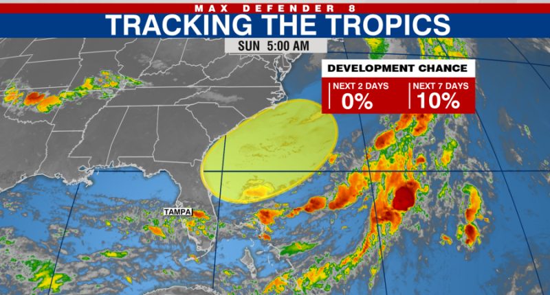
In addition, we’ll examine a region off the Florida coast with potential for development. Even if it doesn’t develop further, it may still bring moisture to the southeastern U.S. coast.

On Monday, the National Hurricane Center pointed out a zone off the southeastern U.S. coast that may develop. A non-tropical low-pressure area is anticipated to emerge in this location.
The system has a chance of gradually developing tropical or subtropical characteristics if it remains offshore. It has a very low chance of development over the next week.
The first tropical storm of the season will be named Andrea.


