Whether it’s rain, snow or a wintry mix, one thing is certain: It’ll be a messy weekend for the East Coast.
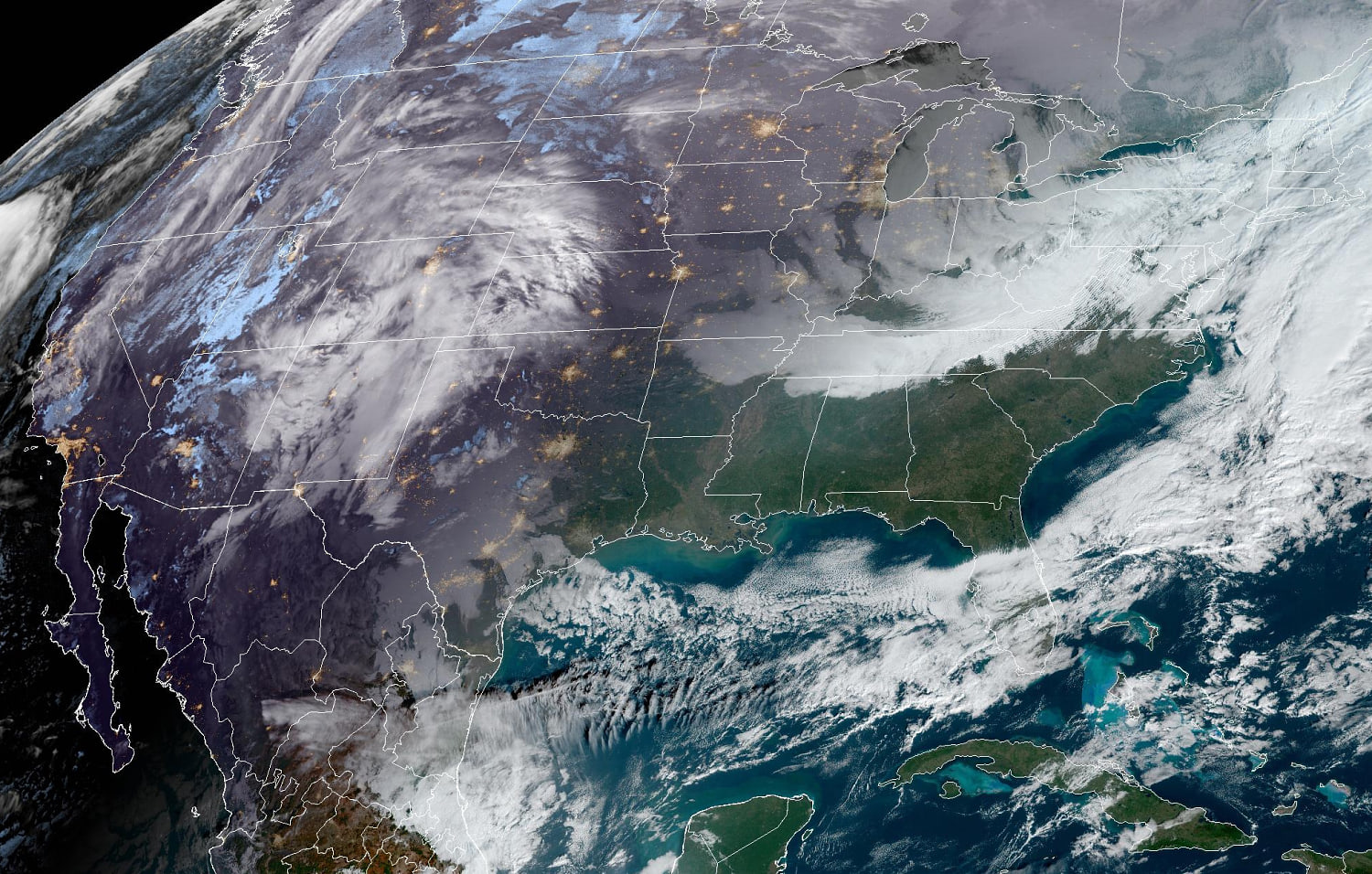
On Thursday morning, the storm system that is expected to affect the East Coast was out West, bringing a mix of snow, sleet and freezing rain to the central and southern Rockies. As the storm continues east through the day, it’ll push wintry weather into the Oklahoma and Texas panhandles as well as portions of Nebraska and Kansas. Showers and thunderstorms were also likely for west Texas by Thursday evening into Friday.
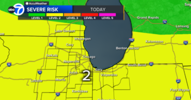
Heading into Friday, as the storm system dips into the South, severe weather will be the primary threat along the Gulf Coast states. New Orleans; Mobile, Alabama; and Gulfport, Mississippi, are all within the risk area that could see damaging winds and the chance of a brief tornado.
As this system intensifies and begins its northward trek Saturday, it’ll bring with it a wintry mess of conditions that will likely cause hazardous travel delays both on the road and in the air.
By Thursday morning, forecast models began converging on a storm track that would likely hug the Atlantic coast. This type of track does not favor a lot of snow for the I-95 corridor, as it typically pulls in warmer air from the Atlantic Ocean, where water temperatures are mild in the 40s and 50s.
With that current storm track the most likely scenario, the greatest snow chances for Saturday will be across the Appalachians and interior portions of the mid-Atlantic and Northeast. A wintry mix, primarily freezing rain, looks likely along the Appalachian mountain chain and Roanoke Valley.
Other areas south and east of the Appalachians and the I-95 corridor will be left with heavy rain and gusty winds heading into Saturday night.
As the center of the storm heads off the New England coast on Sunday, it will leave behind heavy snow and blustery winds for much of the Northeast. Cold air trailing behind the system will make for colder, windier conditions for most of the East Coast and will increase the chances for greater snow accumulation for interior parts of New England. Some lingering snow showers accompany this colder air along the Appalachian Mountains and will continue throughout much of the day.
There is still a degree of uncertainty with this storm in terms of its ultimate track, which will affect the location of the rain/snow line in relation to the I-95 corridor and how much accumulating snow the major metros will get.
The location of the rain/snow line will also determine whether the predominant precipitation type is rain or snow, and if and when a changeover between the two will occur. Per the current forecast, the I-95 corridor from Washington, D.C., to New York will be more wet than wintry, while more northern sections from Providence, Rhode Island, to Boston will see the heavier snow.
At this time, the places that are most likely to see accumulating snow of 4 inches or more will be areas north and west of I-95.
Snowfall chances for Washington, D.C., and Philadelphia are dwindling, with a dusting to 1 inch possible Friday through Sunday, leaving roadways mostly wet. New York is currently seeing a forecast for 1-3 inches, but the trend is for the lower end of that range. Boston and Providence are the major cities that could see 6 inches or more.
In addition to snow, some icing of up to 0.1 inch could be possible across the Appalachian Mountains from North Carolina into West Virginia.