

NEXT 24 HOURS:


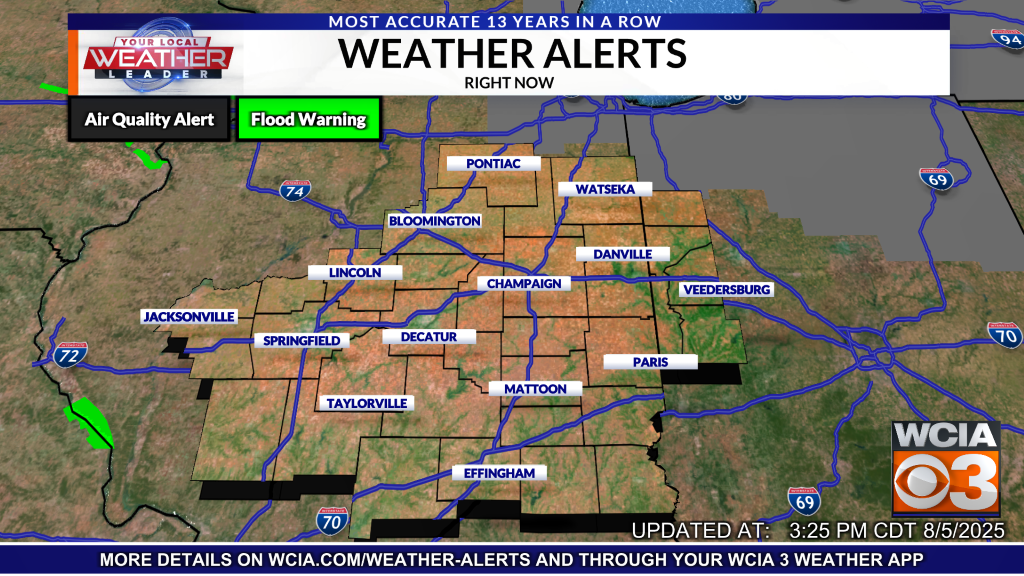
CURRENT WEATHER ALERTS:

Severe and scattered storms hit the I-70 corridor on Wednesday evening, leading to the confirmation of four tornadoes by the National Weather Service. Among these, two occurred in Fayette County, while Effingham County and Coles County each reported one.

The most powerful tornado, classified as an EF-2, swept through an area just east of Shobonier in Fayette County. It recorded estimated winds reaching 114 mph and lasted on the ground for 11 minutes. This same weather system also spawned an EF-0 tornado near Pope prior to evolving into the EF-2 tornado.

Another tornado, labeled as EF-Unknown, was reported on Effingham’s northern side. The EF-Unknown designation indicates that a tornado was visibly observed, but it didn’t cause any damage, thus an official rating couldn’t be given.

Another EF-Unknown was confirmed in Coles County, just north of the town of Janesville.

LOCAL WEATHER FORECAST:
A cutoff low will lock itself in place here in Central Illinois heading into the weekend. As a result, gray skies, parodic showers, and windy conditions will accompany overall cooler weather. For the longest time it looked like we were heading towards a very nice weekend, but this system had other plans.

Normally when we have systems roll through, the upper-level low pressure is able to move along in a timely manner thanks to upper-level winds guiding it along. However, sometimes this low pressure is able escape the jet stream, meaning there is nothing to accelerate it forward. As a result, the low pressure sits relatively still, bringing dreary weather to those beneath it for days at a time.
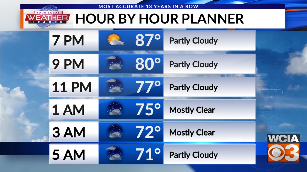
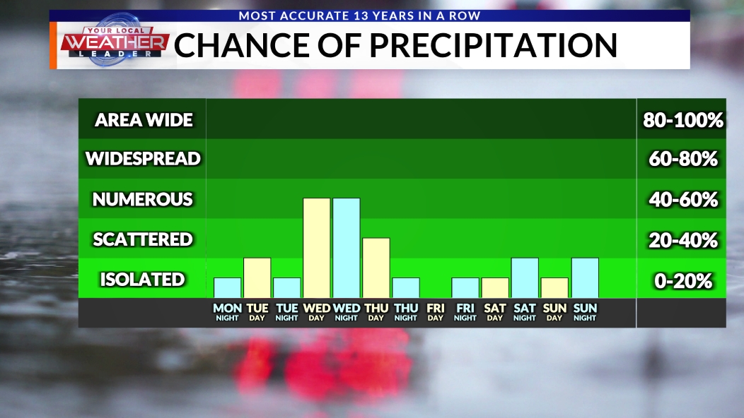
Expect rain chances all throughout the weekend, however the best chances will be this afternoon. Across the southern half of the area, there could even be some heavier showers and light thunderstorms embedded within this system. Severe weather is not likely today.

The cutoff low will remain close enough to us to still bring impacts all the way through Monday and Tuesday of this coming week. As you might expect, rain chances will be present for as long as that system is.
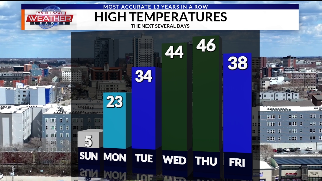
Temperatures likely won’t recover from this system until it exits sometime in the middle of this coming week. Expect some unseasonably cooler days for as long as its around, including some days into the low 60s.
The highest rainfall totals will once again be across the I-70 region, where the heaviest pockets of rain are expected. That said, just about everybody will get in on the rain to some capacity this weekend.

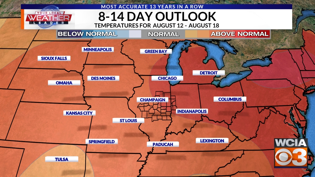
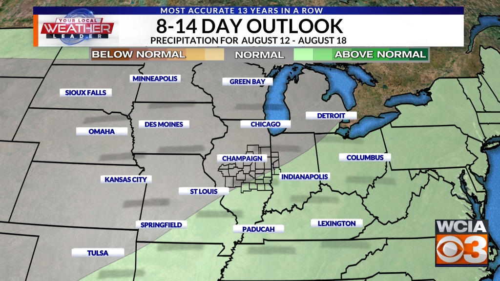
Farther down in this article, you can see the 8-14 Day Outlook that shows drier weather may finally work its way this direction towards the middle of the month, giving us a break from the active pattern that has been in place for the last several weeks.
With severe weather season upon us, consider using WCIA WeatherCall as a way to get calls from us at WCIA in the middle of the night if a weather warning is issued for your location. When you’re asleep, it’s a great way to stay safe. Nothing like a phone call to wake you up and warn you and your family when minutes matter.

Don’t forget to download the WCIA 3 Weather App to stay up-to-date with the latest forecast anytime, anywhere.

7 DAY FORECAST:
Here is your 7 day forecast updated several times a day. You also can see the 7 day forecast and more on the WCIA 3 Weather App and on the WCIA 3 Weather Map Room.

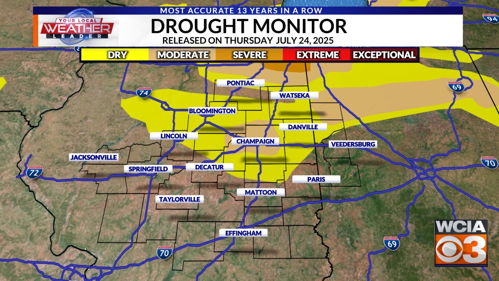
DROUGHT MONITOR:
See the latest drought monitor showing drought conditions in Central Illinois below. The drought monitor is released every Thursday morning and includes rainfall amounts from the Tuesday to Tuesday 7 day window immediately before the drought monitor is released.

LONG-TERM FORECAST:
Here are the latest extended outlooks for the 8-14 day temperature and precipitation outlooks. These outlooks are issued daily and provide insight into the confidence in seeing temperatures and precipitation above or below normal beyond our 7 day forecast.