
The weather forecast for some regions in Australia anticipates chilly and wet conditions this week, with a particular capital city set to receive heavy rainfall.
Perth is bracing for additional showers on both Tuesday and Wednesday.
The rainy spell began on Sunday, and precipitation levels are projected to reach 50mm over three days.

It marks the heaviest rainfall of 2025 for the city, which has seen below-average rainfall totals since the start of the year.
While it will continue to rain until tomorrow, it won’t be too chilly. 
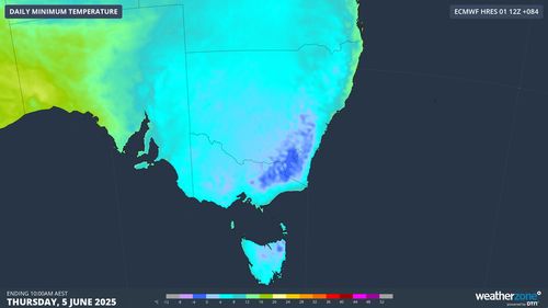
Meanwhile, a cold front will sweep across Australia’s east coast today, producing the first big chill of winter.
The coldest temperatures of the year so far are expected in western and northern NSW, as well as Queensland’s southern regions.
The cold front is expected to head north, stretching to the tip of the state, while the airflow could also bring rain to north-eastern NSW.
The alpine regions could also experience a few centimetres of snow.
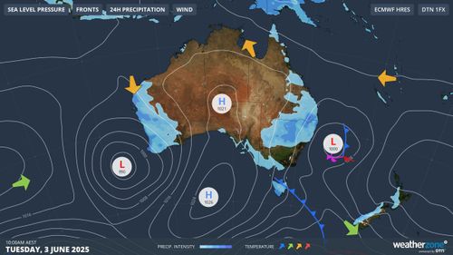
Towards the end of the week, a polar airmass will surge towards south-eastern Australia.
It could bring heavy snowfall to the highest parts of the mainland alpine region.
Weatherzone warned snow lovers that the system could be a hit or miss, as these types of systems are usually unpredictable.
However, most markers indicate the start of the snow season next week should be met with persistent snowfall.