

ORLANDO, Fla. – If you’re planning to head out Thursday or make weekend plans in Central Florida, it’s important to stay vigilant about the weather as the potential for strong to severe storms persists throughout the remainder of the week.
THURSDAY & FRIDAY
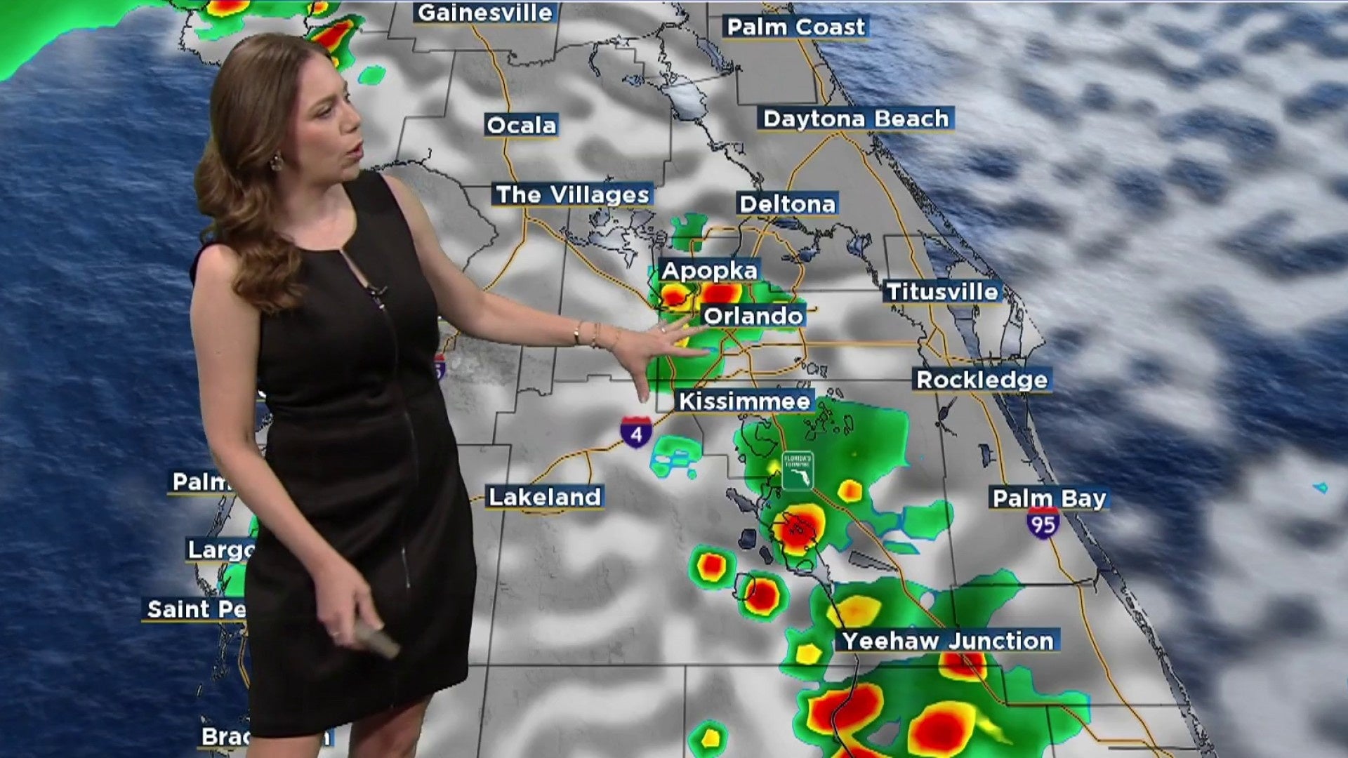
A few coastal showers might occur during the first part of the day as an upper-level low hovers just off Florida’s east coast, contributing to more active afternoons.
[VIDEO BELOW: How to strengthen your weather radio signal]
Storm chances will increase as the day progresses, particularly Thursday afternoon into the evening. Although not everyone will experience rain, there is a 50–60% chance of encountering a passing storm, especially inland once the sea breezes develop.
A Marginal Risk (Level 1 of 5) for severe weather remains in place through Friday as storms will have the potential to turn strong to severe. The storms could pack gusty winds up to 60 mph, along with dangerous lightning, small hail and heavy downpours.
Highs this week climb into the upper 80s to low 90s, but humidity will make it feel more like 100–105 degrees.
[VIDEO BELOW: Man honeymooning in Fla. dies from lightning strike]
WEEKEND
Storm chances increase even more heading into the weekend. Each afternoon, expect scattered to widespread storms, especially where sea breezes collide. Friday may see a few strong to borderline severe storms, similar to Thursday. The pattern stays unsettled through Sunday, so keep the rain gear handy and have a backup plan if you’re headed outdoors.
If you’re heading to the coast, keep an eye on the moderate rip current risk through the weekend.
4TH OF JULY
It’s still early, but long-range models suggest that stormy afternoons may stick around into early next week, including Independence Day.
We’ll be watching closely as another upper-level disturbance moves in, keeping deep moisture over the area. That could mean scattered storms during fireworks time, so stay tuned for updates as we get closer.
Copyright 2025 by WKMG ClickOrlando – All rights reserved.


