
Friday afternoon provided pleasant weather conditions in the Coastal Empire and Lowcountry. Temperatures reached the lower 90s once more, though the high humidity contributed to heat index values climbing into the upper 90s.
A few showers and storms were with us through the evening, though rain chances will be eroding as we head into the overnight.
A LOOK AHEAD
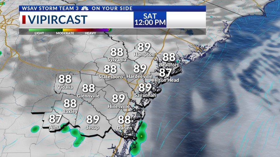
Saturday morning is predicted to begin with partly cloudy skies accompanied by temperatures in the 70s. A partly sunny atmosphere will enable temperatures to quickly rise into the upper 80s to lower 90s before the midday meal.
The afternoon is expected to see highs peaking in the lower 90s, with heat index values reaching the mid to upper 90s. Showers and storms are anticipated to develop by midafternoon, initially along the sea breeze.
Then storms are expected to develop further inland by the late afternoon and into the early evening.


A similar pattern for storms will set up for Sunday as an upper-level low spinning over the southeast will continue to help funnel more moisture into the region. Rain will be heavy at times for both Saturday and Sunday.

Our pattern will remain unsettled for most of next week. The afternoon rain and storm chances will help to keep temperatures near or just above average most afternoons.
Rain chances should back off a little by the later part of the week, though rain chances don’t go away all together.
Next Friday for Independence Day, afternoon highs will be in the lower 90s with a few isolated showers and storms. Most storms at this point should dissipate in time for most firework displays that evening.
TRACKING THE TROPICS
The NHC is monitoring a broad area of low pressure that is crossing over the Yucatan Peninsula as of Friday evening. This system will not develop as long as it is over land.
Once it emerges back over water in the Bay of Campeche, it has a LOW (30%) chance of developing into a tropical depression or tropical storm over the next five to seven days.
There is no threat to the Coastal Empire, the Lowcountry, or the U.S. at this time.