Share this @internewscast.com
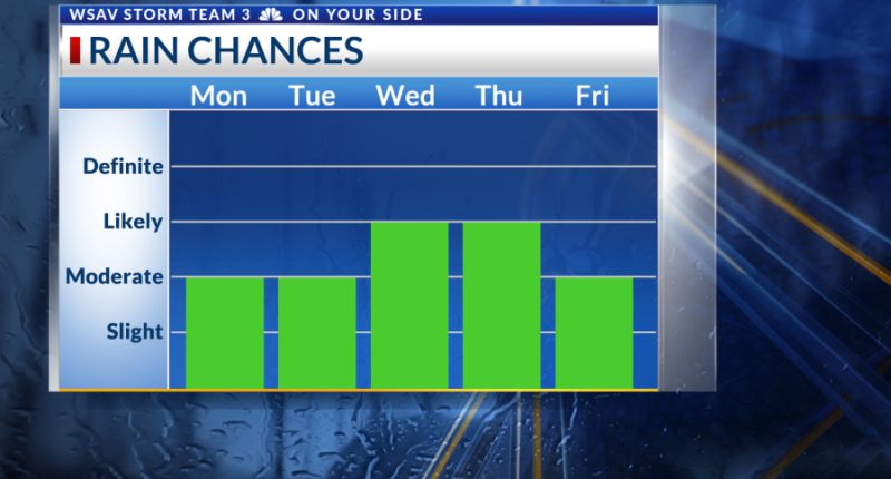
An overnight period with warmth and humidity is anticipated as the evening storms fade away. You can expect the typical sunshine in the morning and midday, with scattered storms in the afternoon.
Tuesday will also feature more of the same ahead of a transition in the pattern.
Midweek Rain Chances / Tropics
A frontal boundary will advance into the region, becoming stationary along the Southeast and Gulf Coasts. This will increase the likelihood of rain for the Coastal Empire and Lowcountry on Wednesday and Thursday.
The National Hurricane Center is also monitoring the Northeast Gulf and areas off the Southeast Coast for the possibility of tropical development.
There is still uncertainty about where an area of low pressure might form and move. If a tropical system does form, the next name on the list would be “Chantal.”
Regardless of tropical development, the most widespread rain chances will come with the frontal boundary Wednesday through early Friday.


At this time, there is less certainty for the 4th of July and the following weekend due to the possibilities involving tropical development. Keep an eye on the forecast as we bring further updates. Do not cancel any plans just yet!
In other tropical topics, Barry is making landfall in Mexico as a low-end tropical storm. This system will dissipate over eastern Mexico Monday.


