

ORLANDO, Fla. – As the Fourth of July weekend approaches, Central Florida is experiencing an influx of deep tropical moisture, leading to a forecast of rainy weather.
Expect widespread rain and thunderstorms through Saturday, particularly during the afternoon and early evening hours.
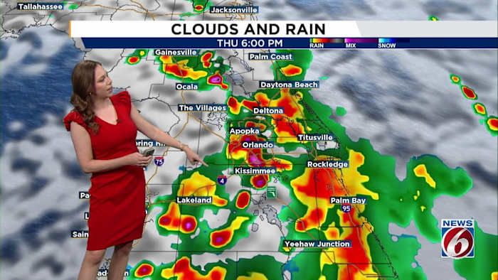
A stationary front in northern Florida will maintain rain chances at 70–80% on Thursday and Friday. While severe storms aren’t anticipated, some stronger storms may bring gusty winds up to 45 mph, frequent lightning, and heavy rain showers.
These conditions raise the risk for minor flooding, especially in areas that get repeated rounds of rainfall over the next few days. Rainfall totals could reach between 1 to 3 inches, with some isolated spots seeing even more.
4th of July Weekend
While it’s not expected to rain all day, be prepared for multiple waves of storms that could impact your outdoor plans for the Fourth of July.
That means fireworks displays, backyard barbecues and beach outings might get rained out or delayed thanks to passing downpours.
With the cloudy skies and rain-cooled air, highs are expected to stay in the upper 80s, making it possibly the coolest July 4 that we’ve seen in 15 years!
Stay on guard this holiday weekend, keep an eye on the radar if you’re plans take you outside through the next few days and keep your plans flexible.
Tropics
The same area that is bringing Central Florida higher-than-normal rain chances for the weekend is being closely monitored by the National Hurricane Center.
Tropical development will be possible off the Florida coast over the Atlantic.
The latest update gives the area a 50% chance of further development over the next seven days.
Regardless of development, our soggy weather outlook remains unchanged.
Next Week
Looking beyond the weekend, rain chances begin to decrease on Sunday, returning to more typical summer levels (around 40–60%).
With drier days and more sunshine, highs get back to the low 90s, with heat indices returning to the triple digits.
Copyright 2025 by WKMG ClickOrlando – All rights reserved.


