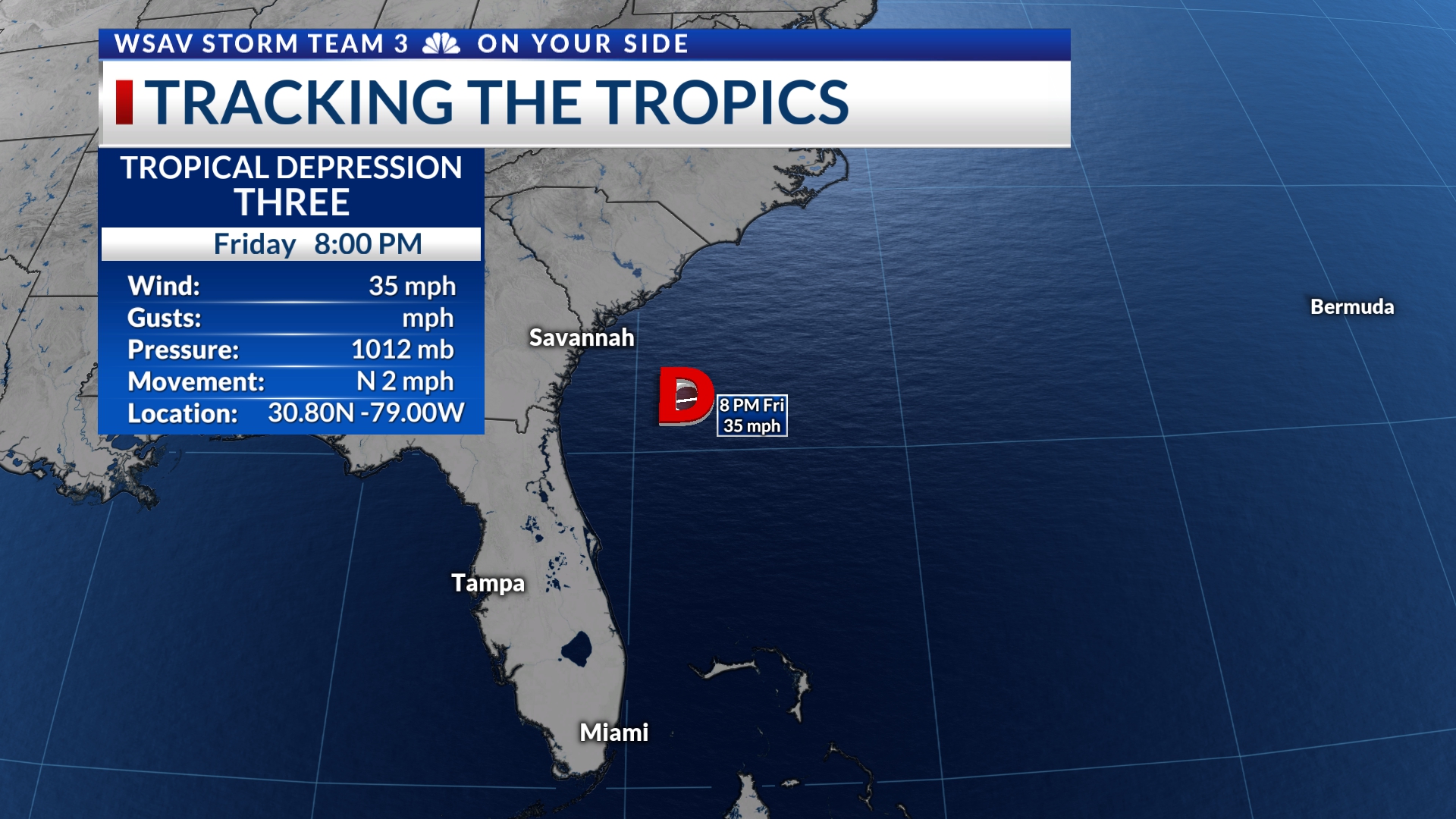

SAVANNAH, Ga. () — The once disorganized area of cloudiness we’ve been monitoring for potential tropical development has now become more structured and is classified as Tropical Depression Three.
Hurricane hunters were investigating this system Friday afternoon and found a defined circulation making it a tropical depression at 5 p.m.


As reported at 8 p.m., T.D. Three has maintained its strength with sustained winds clocking at 35 mph. Wind gusts have reached 45 mph as well. It is located approximately 150 miles off the coast of Georgia, moving slowly northward at 2 mph.
T.D. Three is anticipated to gradually intensify prior to its landfall near Charleston, S.C., which is expected late Saturday night or early Sunday morning. Forecasts predict it will develop into a tropical storm by sometime Saturday. The next name on the 2025 Atlantic naming list is Chantal.
A Tropical Storm Watch has been issued for Edisto Beach and northward along the South Carolina Coast to the Little River Inlet on the North Carolina boarder.

LOCAL IMPACTS
Local impacts from T.D. Three are expected to be minimal and concentrated near the coast. The primary coastal concerns will be breezy and gusty wind up to about 35 mph at times. Strong on shore wind will lead to rough surf and a high rip current risk for Georgia and South Carolina.
As this system makes its way toward the Charleston area, scattered rain and storms are expected locally. Some rain will be heavy at times. Minor localized flooding is possible mainly for Beaufort County. However, most of the Coastal Empire and Lowcountry that covers will receive less than one inch of rain.


This system will not be a major wind or rain even for most of coastal Georgia, Savannah, or for our inland communities.
T.D. Three is expected to remain a lopsided system. This means most of the thunderstorms and wind will remain on the eastern side of the storm, leading to the lower local impacts.


