
As it heads toward South Carolina this weekend, it’s expected to make landfall early Sunday as a low-end tropical storm
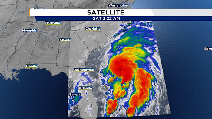
ORLANDO, FL – On Friday afternoon, Tropical Depression Three developed around 150 miles east of Jacksonville and is anticipated to intensify into Tropical Storm Chantal by Saturday afternoon.
A slow movement towards the north-northwest is expected to start later today, aiming for the South Carolina coast by Saturday night and early Sunday morning. The latest update from the NHC (as of 5 AM Saturday) reports that it currently has winds of 35 mph, with a slow north-northeast movement at just 2 mph, and a minimum central pressure of 1010 millibars.
While the storm isn’t expected to bring heavy impact, gusty conditions and rough surf will impact the Carolinas coast line through the weekend.
On a more positive note, no further tropical threats are predicted for the Atlantic. For those interested, the list of names for the 2025 Atlantic Hurricane Season begins with Andrea.
Copyright 2025 by WKMG ClickOrlando – All rights reserved.