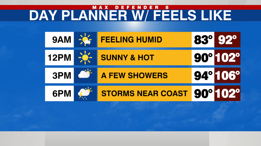

TAMPA, Fla. (WFLA) — Temperatures heat up quickly today with well above average highs in the mid-90s.

Rain chances will increase to a 50% this afternoon and evening for storms that meander southwest toward the coast.
Slightly drier air will limit rain chances to just a 20% Wednesday afternoon for a few spotty showers but it will be hot with highs near 95 degrees.

Tropical moisture is set to return, starting Thursday and extending into the weekend as onshore winds develop. This will increase rain probabilities, with showers and storms initiating earlier in the day, moving from the Gulf to the east coast by evening.
Hurricane Erin remains a significant category three hurricane according to the latest 5 am advisory. The storm is expanding in size, and while a direct hit is not expected, the Outer Banks of North Carolina could experience tropical storm-force winds. The heavy surf will lead to hazardous rip currents along the east coast and contribute to coastal erosion due to substantial swells.

Two other tropical waves are being monitored in the central and eastern Atlantic.

According to forecast models, both systems are expected to head towards the Caribbean Islands this weekend. Neither system currently threatens the Tampa Bay area over the weekend. We’ll continue to monitor their progress and potential developments heading into next week as they evolve.