

Tropical Storm Humberto emerged in the Atlantic Ocean on Wednesday while Hurricane Gabrielle sped toward the Azores islands, according to forecasters.
A hurricane warning was issued for the volcanic island group, which may face hazardous conditions from Gabrielle starting Thursday, the National Hurricane Center in Miami reported.
Although Gabrielle is expected to weaken, it could still cause severe coastal flooding and produce large, destructive waves in the Azores, forecasters cautioned. The storm might deliver up to 5 inches (13 centimeters) of rain over the central and western Azores from Thursday into Friday.
As of late Wednesday, Gabrielle was approximately 855 miles (1,375 kilometers) west of the Azores in the Northern Atlantic. It had maximum sustained winds of 85 mph (140 kph) and was moving eastward at a speed of 31 mph (50 kph).
Waves from Gabrielle are predicted to impact Bermuda, the U.S. East Coast from North Carolina northward, and the Atlantic coast of Canada, forecasters warned, with life-threatening surf and rip currents possible.
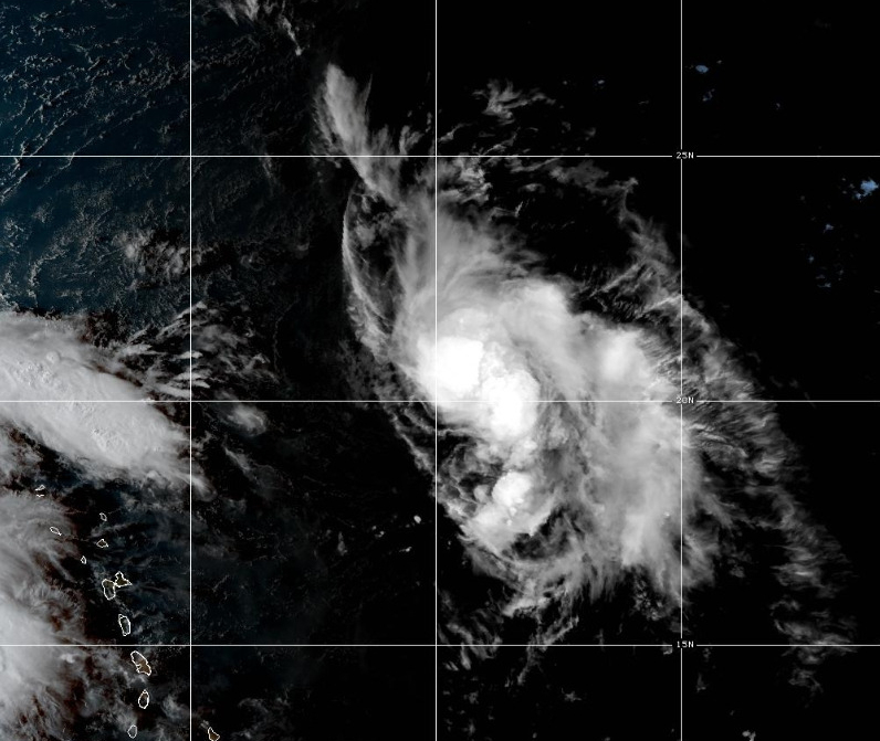
Meanwhile, Tropical Storm Humberto was positioned 505 miles (815 kilometers) east-northeast of the northern Leeward Islands, boasting maximum sustained winds of 45 mph (75 kph), the weather center noted. Humberto could influence the eastern U.S. coast with winds reaching 39 mph within the next five days.
In the Pacific, Hurricane Narda was moving away from Mexico, forecasters said. It had top sustained winds of about 90 mph (150 kph) late Wednesday.
Narda was about 580 miles (935 kilometers) south-southwest of the southern tip of Mexico’s Baja California peninsula, and was moving west at 10 mph (17 kph). No coastal watches or warnings were in effect as the hurricane was expected to continue moving further offshore.
Swells generated by Narda could bring rough surf and rip current conditions to some parts of coastal Mexico, forecasters said. The hurricane was expected to weaken over the next day or so, but restrengthen on Thursday and Friday.