
A PTC is a classification given to a system when it has not quite reached depression or tropical storm status.
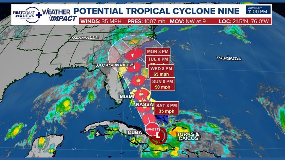
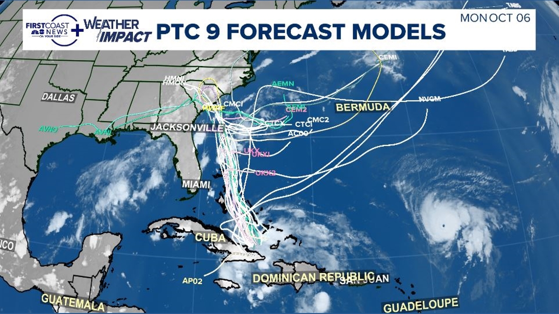
JACKSONVILLE, Fla. — The National Hurricane Center has issued advisories on Potential Tropical Cyclone Nine.
Once known as Invest 94L, the low-pressure system is positioned near eastern Cuba. It is expected to progress northwestward, moving towards the Bahamas and the southeastern U.S. coast.
A Potential Tropical Cyclone refers to a system not yet achieving depression or tropical storm classification but for which additional forecasting tools, such as a cone, are provided.
Tropical storm watched and warning have been issued for the islands of the Bahamas.


This classification is crucial due to timing issues. Because the system will likely develop close to land, it offers essential decision-making information for a potential early next-week landfall. Hence, it’s important to take precautions in advance.
Forecast confidence remains somewhat low by Monday, causing the projected path to widen, encompassing areas from the North Carolina coast down to northeastern Florida. This makes it vital to stay informed about the weather and prepare for possible tropical impacts locally by Monday.
According to the current forecast, the main effects for the First Coast are likely to include coastal issues such as dangerous rip currents, high surf, and strong winds.