
It will soon strengthen into Tropical Storm Imelda.
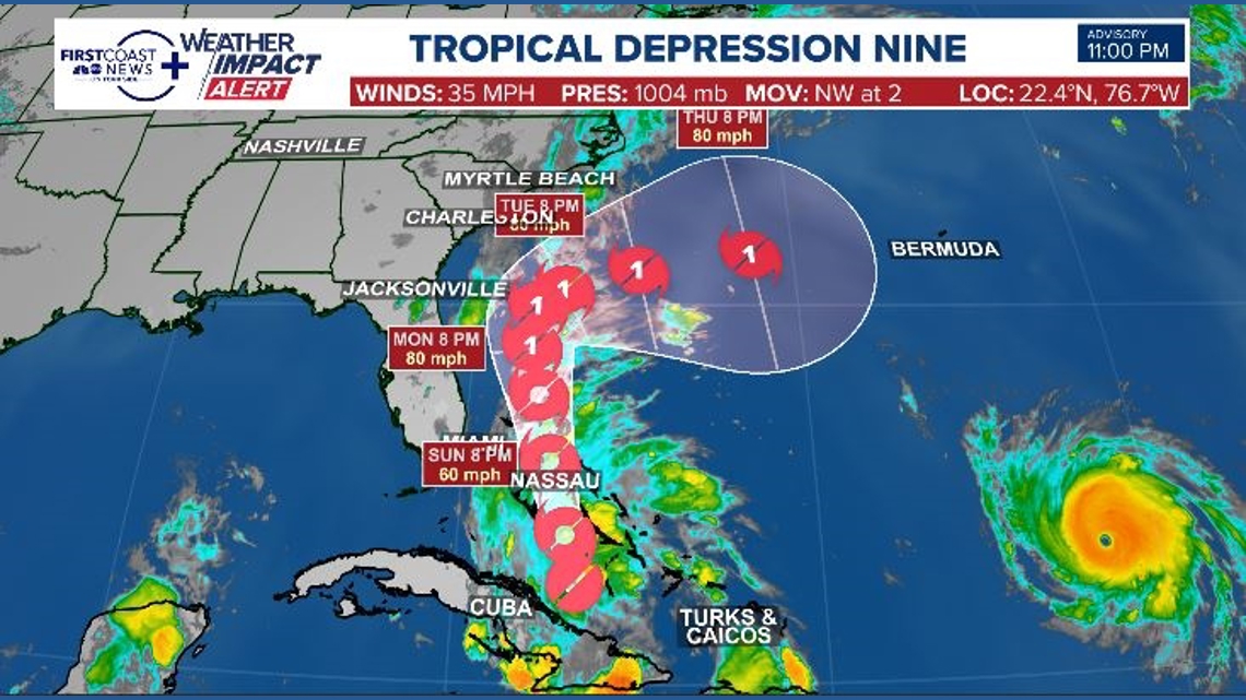
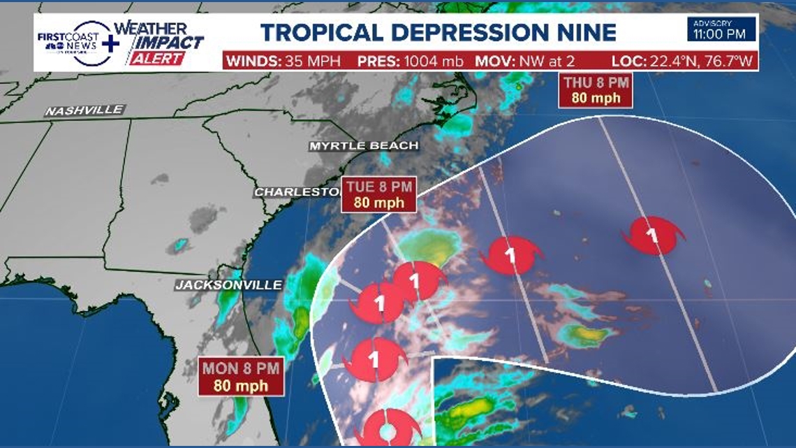
JACKSONVILLE, Fla. — Tropical Depression Nine continues its advance northward toward the Bahamas. It currently exhibits winds of 35 mph and a slow northwest progression, clocking a forward speed of 5 mph.
The storm is expected to maintain a path parallel to Florida’s coast, eventually decelerating and sharply turning eastward. Presently, the projected path steers clear of any US southeastern coastal land. The depression is anticipated to strengthen into Tropical Storm Imelda by Saturday evening.
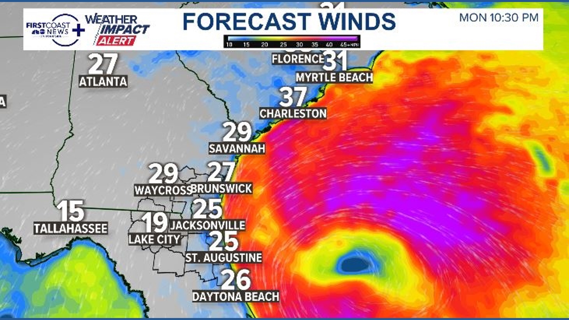
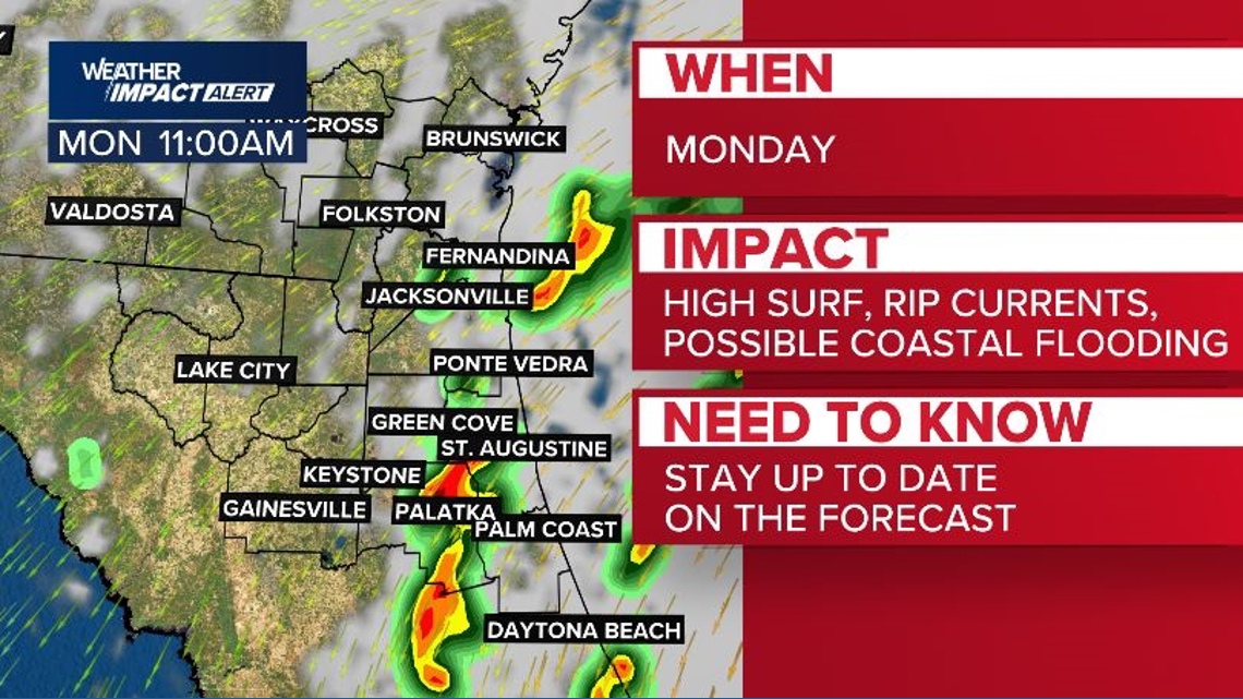
Our region will start experiencing effects by Monday. Winds from the northeast will intensify, starting at 10 mph and escalating to 25 mph along the coast, with slightly weaker winds inland. By late day, gusts might reach up to 30-35 mph at the beaches.
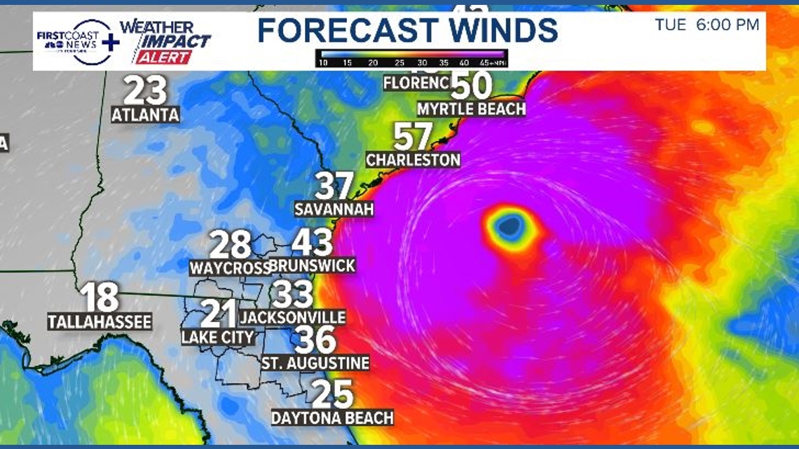
Tuesday winds will pick up to 20-30 mph with gusts to 40 mph at the beaches. The strongest winds will remain at the beach.


The storm is expected to maintain a path parallel to Florida’s coast, eventually decelerating and sharply turning eastward. Presently, the projected path steers clear of any US southeastern coastal land. The depression is anticipated to strengthen into Tropical Storm Imelda by Saturday evening.
Our region will start experiencing effects by Monday. Winds from the northeast will intensify, starting at 10 mph and escalating to 25 mph along the coast, with slightly weaker winds inland. By late day, gusts might reach up to 30-35 mph at the beaches.

Tuesday winds will pick up to 20-30 mph with gusts to 40 mph at the beaches. The strongest winds will remain at the beach.
Although not expected to produce significant rainfall, sporadic bands of heavy rain will intermittently impact the area on Monday and Tuesday. With heavier rain localized, particularly near the coast, there’s potential for isolated flash floods due to possible repetitive rainfall.
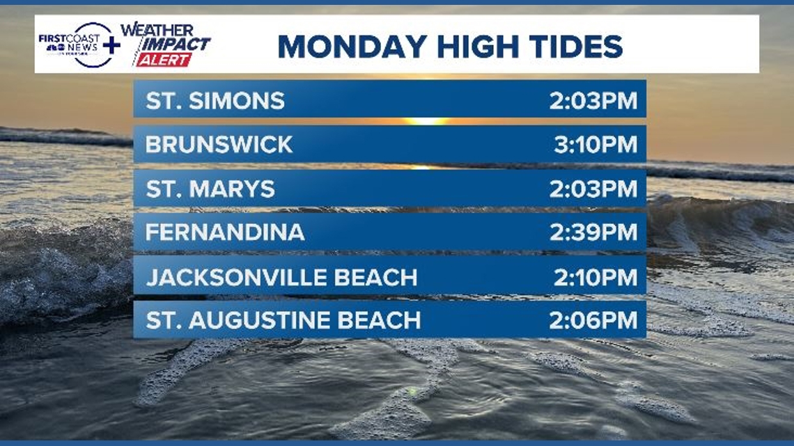
As water is pushed toward the beaches and into the river, we could get a 1-2 foot surge, meaning coastal flooding will be likely at times. of high tide.
Here are your high tides for local coastal communities for Monday:


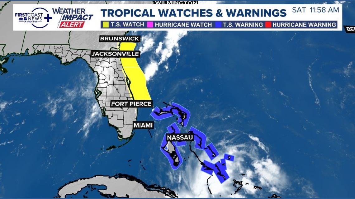
Tropical Storm warnings have been issued for the islands of the Bahamas, while Tropical Storm watches have been issued for the east coast of Florida and coastal Southeast Georgia. The tropical storm watch for the northeast Florida, southeast Georgia area is for offshore waters currently, the watches impacting land would be from Volusia County south to Martin County. This could be updated to include the coastline of the First Coast and Georgia later Saturday night.

Main impacts for the First Coast look to be coastal issues like dangerous rip currents, large surf of 6+ feet, and gusty winds. Outer bands could move onshore Sunday night into Monday, which could occasionally bring some areas on the First Coast heavy rain and gusty winds.

Please check back in for updates to the forecast – we’ll know more about impacts from outer bands as the storm gets closer.